
I was picking up family at Toronto Pearson International Airport from a flight arriving at 1am. This basically gave me an evening to myself to spend some time in Toronto before heading to the airport. I love night photography. I got to do what I love.
September 1, when Canadians think of that date, they think of the impending winter and temperatures, as if on cue, dropping to autumn levels. Not in 2015. The temperature, even after midnight, in Toronto remained at 25c or around 80f. The air was thick with haze and humidity. The Toronto waterfront was vibrant.

After all, not only was the weather unseasonably warm, there was a ‘super moon’ on the rise over Lake Ontario that was a giant, red coloured spectacle for quite some time. The Toronto Blue Jays are playing World Series worthy baseball and were tangling in a close game with the Cleveland Indians at Rogers Centre. The Canadian National Exhibition was in it’s prime and full with thrill seekers.
Coming from a town where the streets empty out when the sun goes down, regardless of the time of year, the number of people enjoying the waterfront, even as late as midnight, made me wonder just how much life I was missing.

It turns out, people weren’t the only ones enjoying the night life. At Humber Bay Park East, from where the next two images are taken from, I was on constant alert for raccoons. Now, in Orangeville, we have plenty of raccoons, as well. In fact, this year, I’ve had to chase them off my back porch on numerous occasions. Like Toronto, the raccoons in Humber Bay Park were simply bigger. And, quite a bit more aggressive.

Luckily, I didn’t have the bomb squad called on me at any of the points were I took these 15-30 second images. While taking Bobcaygeon, Ontario night shots last week, a summer rarity occurred and I was wearing a rain coat. My remote shutter control was left in that rain coat. That rain coat sat on a hook an hour’s drive away.
Therefore, to not shake the camera in any way, I had to use the ten second timer. So, after pushing the button on every image, there would be ten seconds worth of beeping before the exposure would start. The beeping sounds very close to a time bomb – at least, the one’s you see on television.
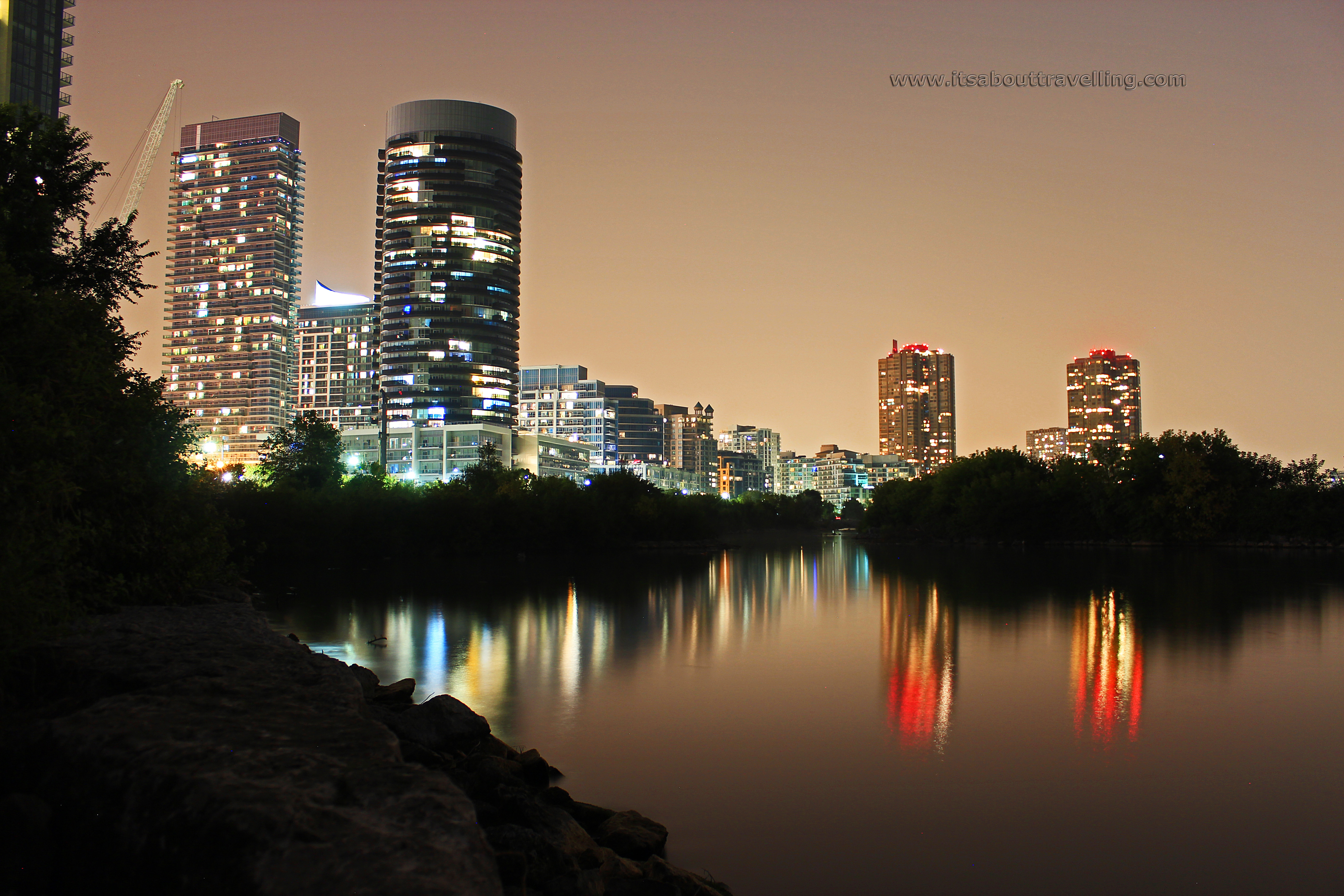
Humber Bay Park is divided into East and West, with the Mimico Creek as the barrier. This is an urban park with 47 acres on the east side an 104 acres on the west. This piece of land that juts out into Lake Ontario is actually manmade, created from the accumulation of clean fill. The park opened in 1984 and is an interesting mix of views of high density landscapes and high density nature.
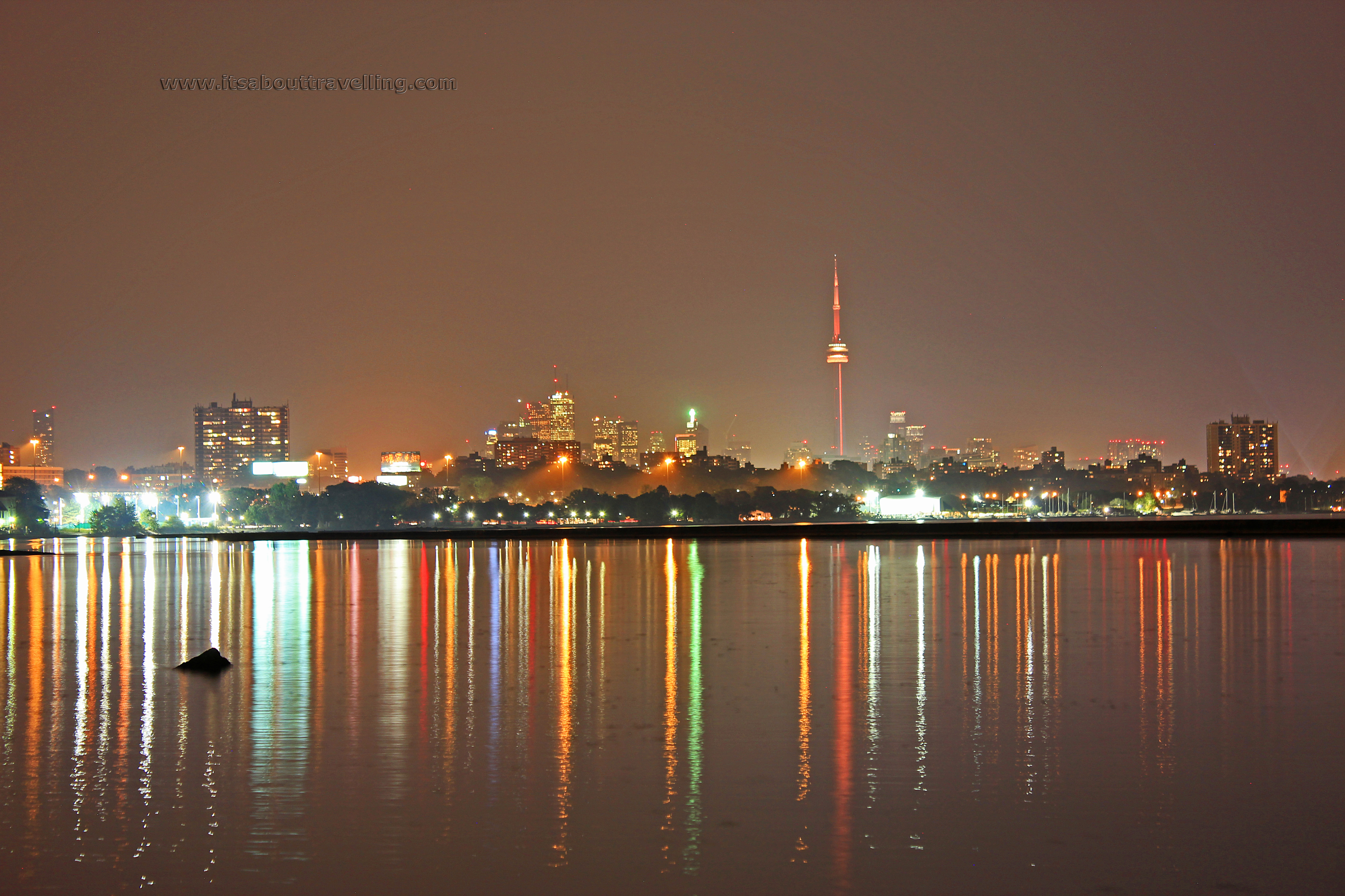
The above image was taken from the shore at Sir Casimir Gzowski Park. This is the first bit of parkway just east of the Humber River. There is well lit parking here and there are no parking fees after 9pm.
Gzowski was a Canadian rail pioneer who also did engineering work on the Welland Canal. Just prior to his death in 1898, he served as Lieutenant Governor of Ontario. For those not in the Commonwealth, that position is basically the Queen of England’s bitch.
My evening started off a little further west at Port Credit. I mistakenly assumed that the pier in Port Credit would be void of humans after 9pm on a Tuesday night. That could not have been any further from the truth. The area was crawling with people.
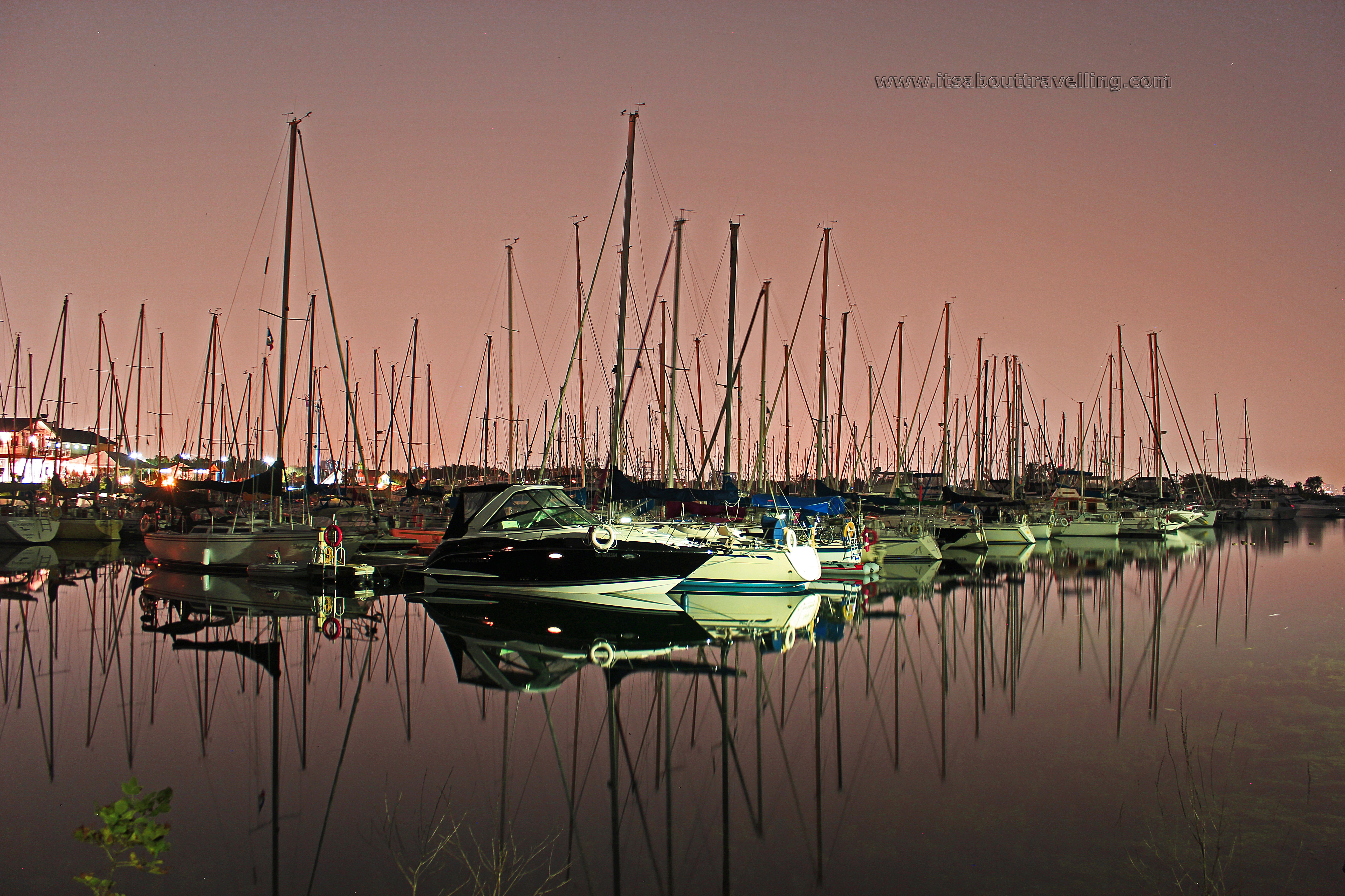
Not loving a crowd, I moved a little further into Mississauga and stopped at the Lakefront Promenade Park. This is a 104 acre park, just east of Cawthra. I’m pretty sure this is the location of the finish line from when I ran the Mississauga Half Marathon a few years ago.
The image above was taken at this park and shows the sleeping boats of the Lakefront Promenade Marina.

Also shown in the second picture from the top, the above is the Humber Bay Arch Bridge with the Toronto skyline in the background. The arch rises 70 feet and the bridge spans 456 feet across the Humber River. The Arch Bridge opened in 1994 and accommodates pedestrian and bicycle traffic only.
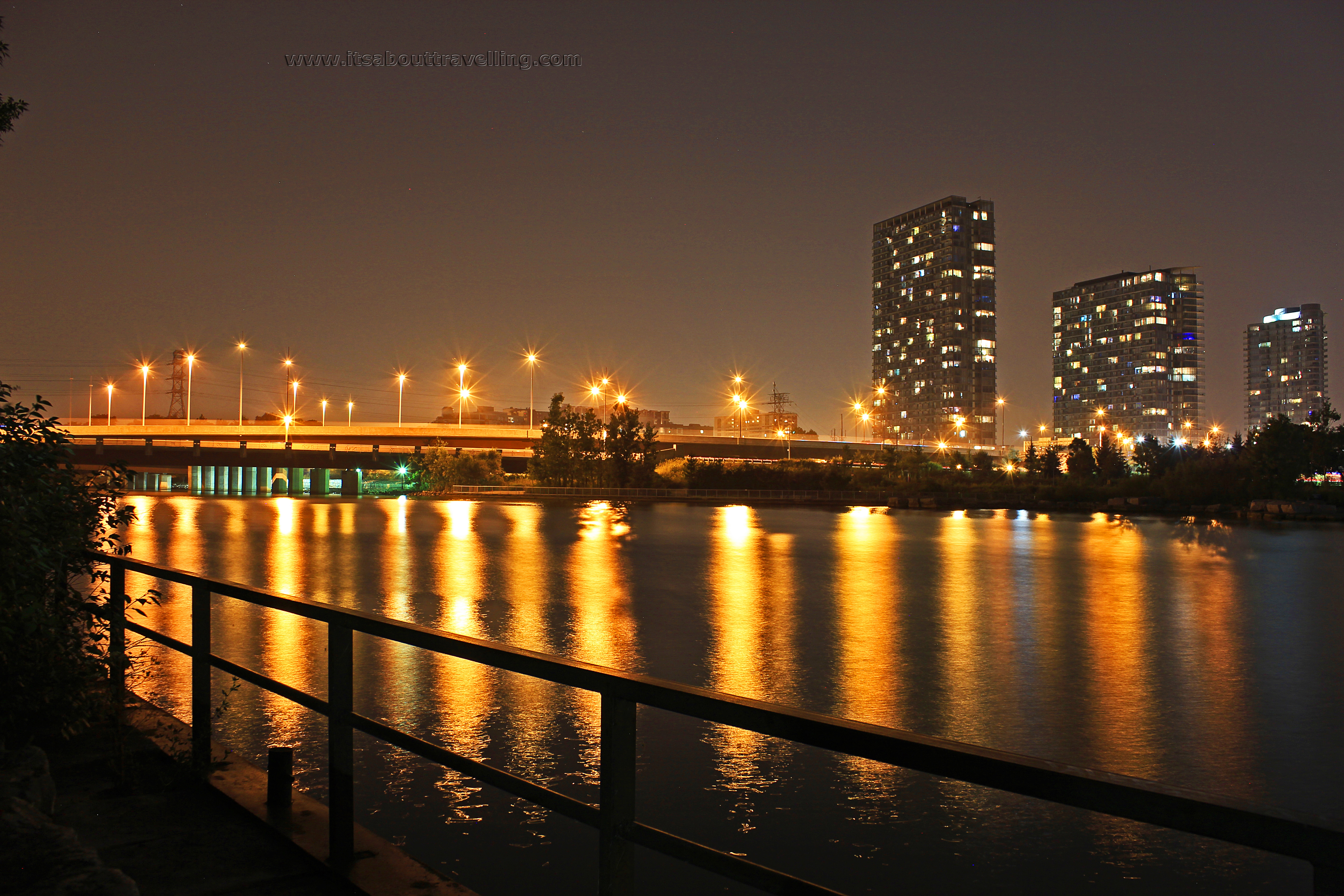
Above is the view looking north, away from the Humber Bay Arch Bridge. This is the Humber River with the Lakeshore Blvd. and Gardiner Expressway bridges crossing over.
