Go into Costco during the COVID-19 pandemic restrictions? Not bloody likely! So, when you drop your wife off at the Costco in Guelph and you’re looking to kill time, what to do?
I needed exercise. My nagging heel injury was nagging me to the point where the hills of the Bruce Trail around our home were out of the question. I needed flat exercise…
The Speed River Trail had caught my eye many a time before. I’d often seen cars parked just past the Wellington Road 32 bridge over the Speed River and had spotted the trail entrance signs.
It followed the river. I knew the terrain all around this section of trail. I knew that if there were hills, they just couldn’t be that steep. This was definitely not the Bruce Trail.
More on the trail below the video…
Speed River Trail (Section 3) Video
The following video was taken from Roszell Road in the west to Wellington Road 32 in the east. This is a POV of the 4.6 kilometre stretch of trail.
If you like what you see, please give it a ‘Thumb’s Up’ in YouTube. We would be forever grateful if you’d consider subscribing to our YouTube Channel!
Speed River Trail
The section of hiking trail shown in the video above is just a portion of the Speed River Trail (SRT). The full trail, maintained by the Guelph Hiking Trail Club, covers 13.4 KM over four sections.
It’s sort of a cross between an urban and rural trail. You certainly get the feeling you’re in the wilderness over much of the trail. But, there is constantly signs that you are, indeed, very close to civilization. For the most part, it is an enjoyable, peaceful jaunt through a natural environment.
A word of warning, as per the signs at the entrance to the trail, this land is open to hunters in season. I’ve done this stretch a grand total of twice, out and back, and I have yet to be shot at. However, I did come across a hunter on one occasion so do be cautious.
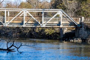
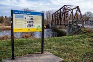
The trail ends at Roszell Road in the west. But, if you walk the road, you will soon cross the historic Black Bridge Road Bridge. On the other side of the river, there is another set of trails, along with a spot to launch a canoe or kayak onto the Speed River (watch this site for more on that when the weather gets a bit more summery).
My Opinion On The Trail
Overall, I think this is a great hike. Both times I hit it, the mud was a bit of an issue in spots. But, if you want a paved trail, there are plenty running through the neighbourhoods of the surrounding big cities.
As a photographer, I think the potential is in the variety of gnarled trees that have such great character given the right moody weather conditions. As seen in the video, there are remains of a stone foundation of, I’m assuming, a barn. The Wellington Road 32 bridge also has some character and is somewhat photogenic.
I have a feeling that this might be a bit of bug haven in the warmer months. Running along the south side of the river means it’s often in shade for much of the day. There seems to be a lot of spring runoff that keeps the ground quite moist in some densely forested areas. To me, this would seem to be a mosquito hotbed.


