
My first experience with Rockwood Conservation Area came when I was just a kid in the 1970’s. My older brother was in a baseball tournament in nearby Georgetown so my Mom, Dad and I camped at Rockwood. It was a thing we did, following my much older brother around during the summer months.
Joining us was an old friend of my parents who lived in Georgetown. I’m dating our visit at around 1974 or 1975 when I was six or seven. My recollection is spotty but I do recall the friend complaining about the newly amalgamated municipal government of Halton Hills that blended Georgetown and it’s surrounding area. This took place in 1974 and was pretty much an unheard of government move at the time.

From that first visit, I remember how much fun I had scrambling around the rock ‘potholes’ and cliffs – something that is mostly prohibited today. And, there was ‘Honey’.
At a nearby campsite, there was an amorous young man who spent most of the evening loudly trying to coax his girlfriend into some action. “Oh, Honey!” “Come on, Honey!” “Please, Honey!” It went on and on into the wee hours, providing us with constant entertainment throughout the evening. Honey wasn’t exactly quiet in her refusals.
I’m not sure if he got some that night, but every time I drive past that campground (a campground that has changed little in 40 years) I have to laugh in memory of ‘Honey’.
Rockwood Conservation Area
Rockwood Conservation Area is located on the west side of the small town of Rockwood, Ontario. The park is directly off highway 7 and just north of highway 401. Rockwood may be a small town but this is some of the most densely populated area in Canada. The park is located between Guelph and Acton, not far west of the Greater Toronto Area. Yet, if you visit on a weekday, preferably outside the months of July and August, you can still convince yourself that you’re in a remote forested campground.
My visits since the 1970’s have been strictly day-use and I haven’t used the campground since. I’m hoping to change that sometime this summer. However, the best of this park is what you see on a day visit.
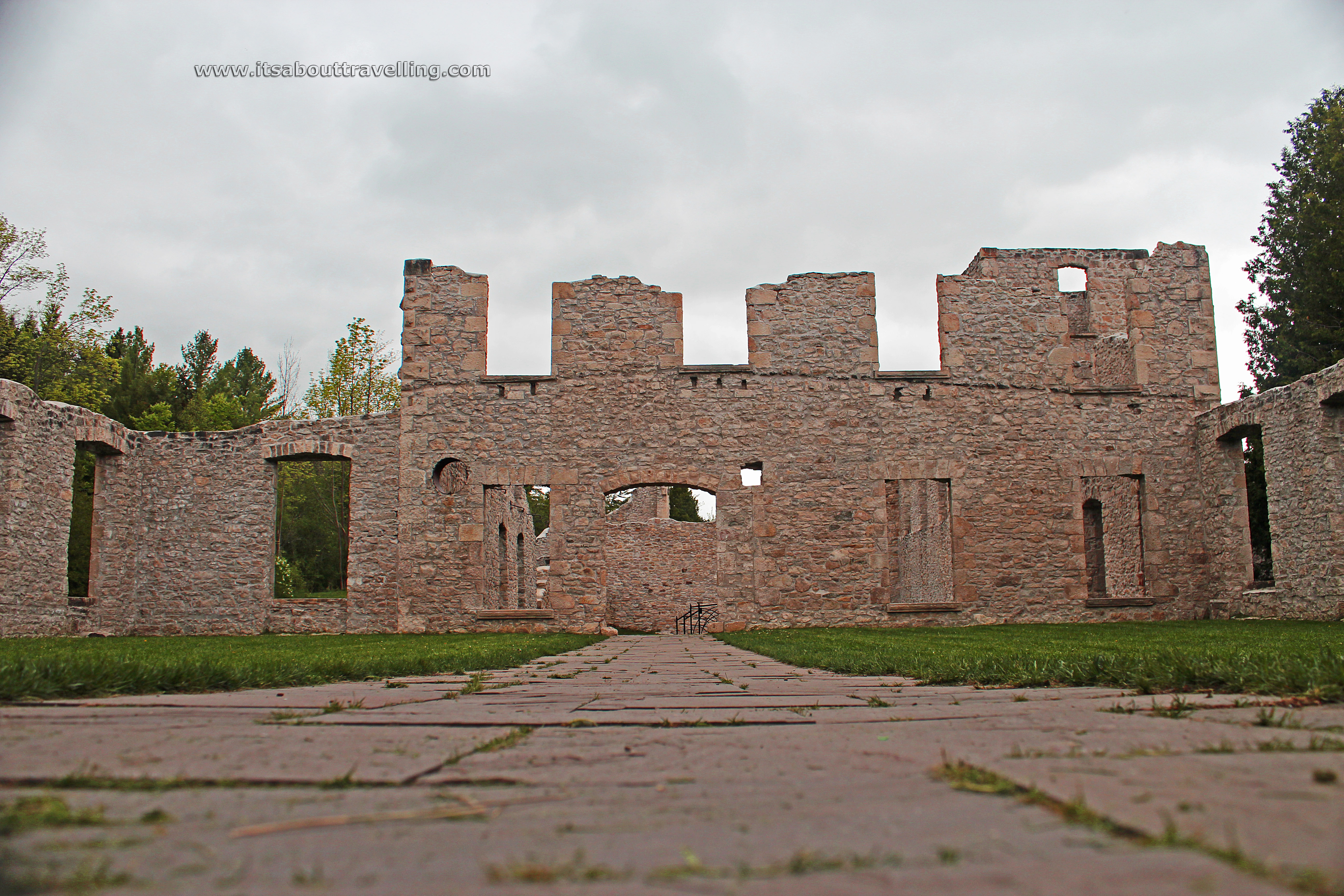
Back in 1867, the Eramosa River was dammed up for the newly founded Rockwood Mills (Harris Woolen Mills). John Harris became Rockwood’s first settler in 1820. His son John Richard Harris was born in 1937 and it was him that opened the mill.
In 1884, a newer, bigger, stronger mill was built and that building’s skeleton remains today as a highlight of the park. The mill ceased operations in 1925. The Grand River Conservation Authority bought the land in 1958. The mill accidently burned down in 1967 with just the stone walls left behind. Just recently, the walls have been fortified.
The mill ruins are a portrait photographers dream and are a popular spot for weddings. Until recently, water continued to flow through the centre of the mill. That water has since been blocked and stones are now artistically in its place.
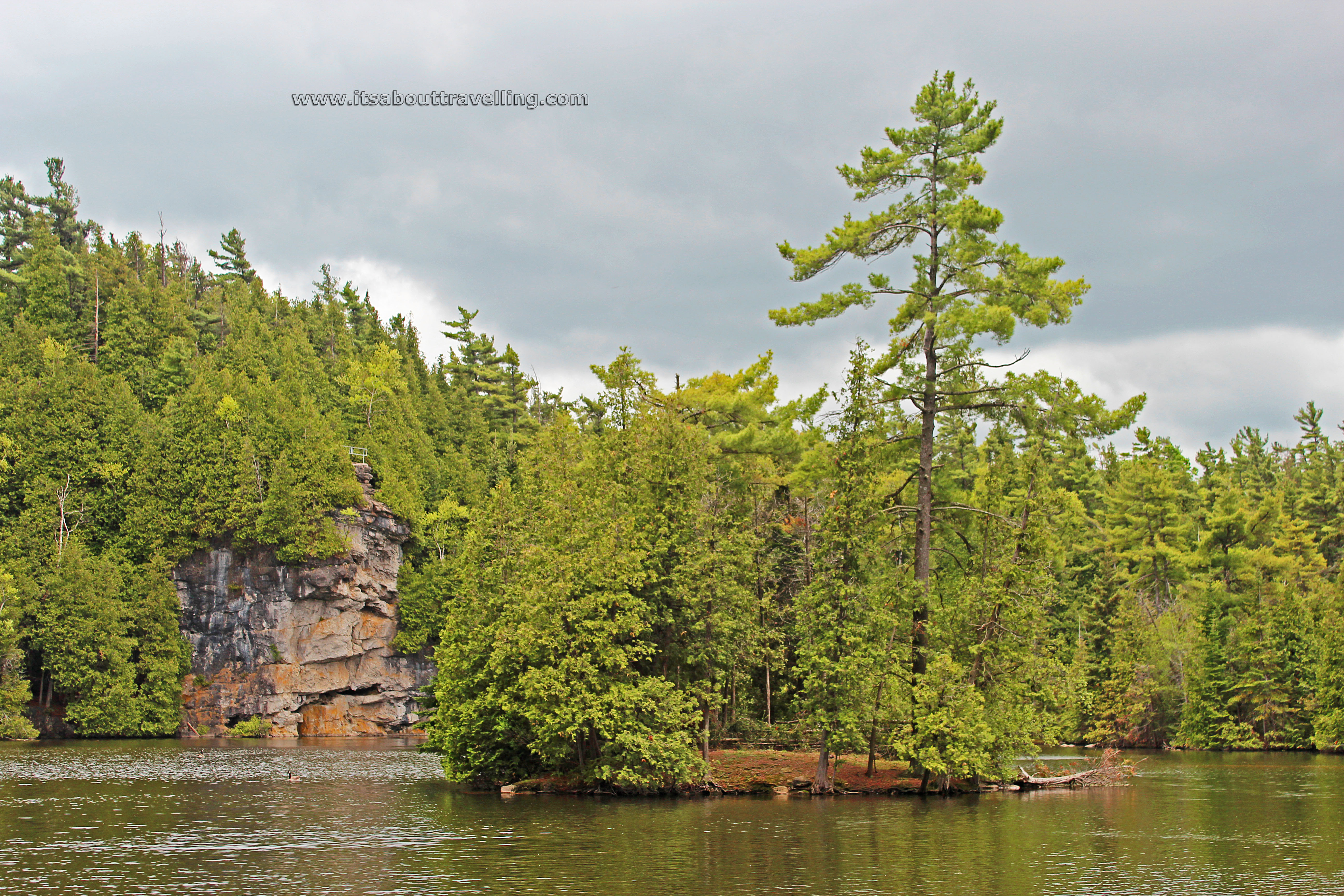
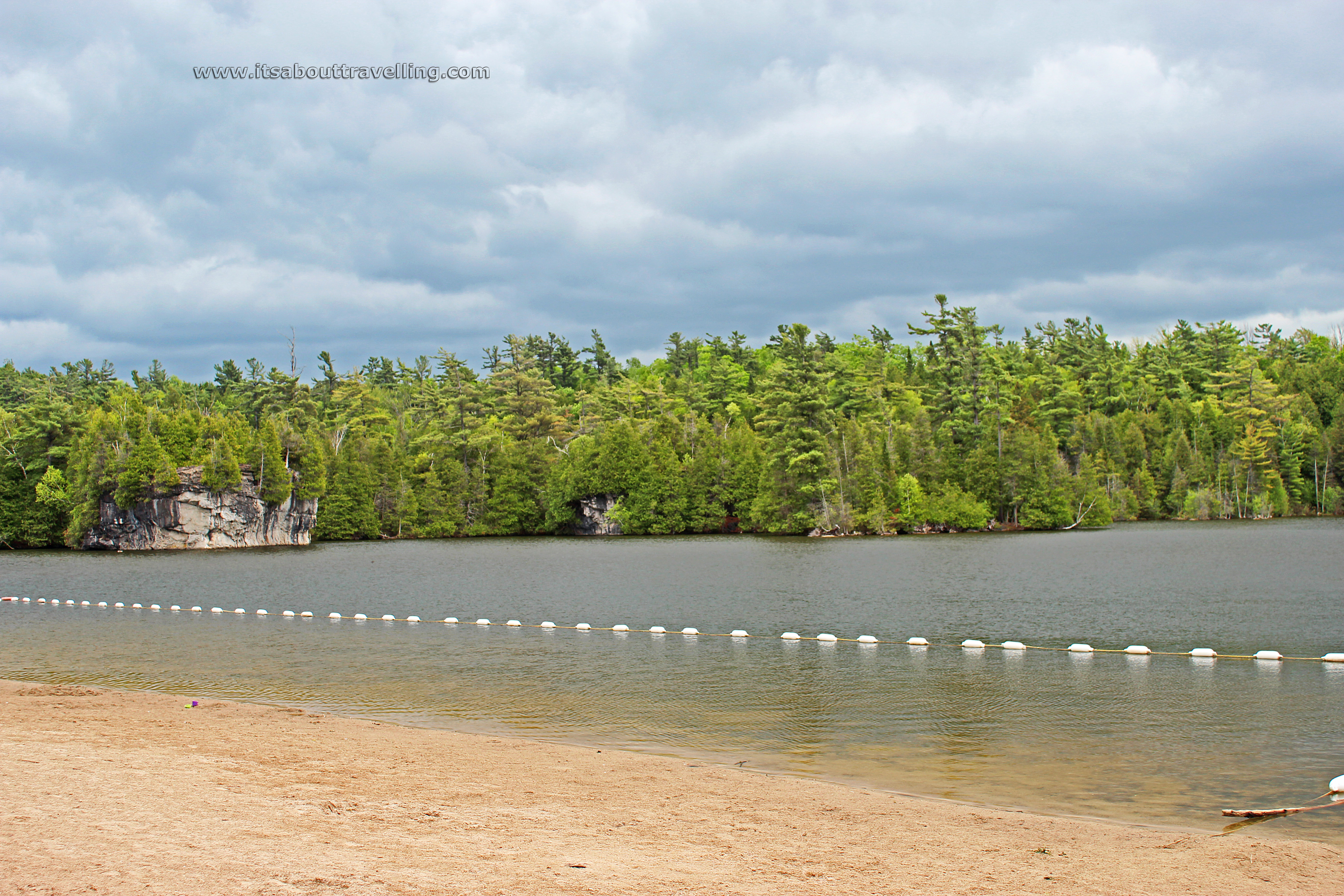
A second dam, just past the beach area, creates a lake between the ruins and the western extent of the park. The lake is surrounded by cliffs that rise up to 30 metres or 100 feet above the water level. There are numerous potholes surrounding the lake, more on the campground side. These are remnants of glacial activity in the area. Some are filled with water and make for a unique landscape.
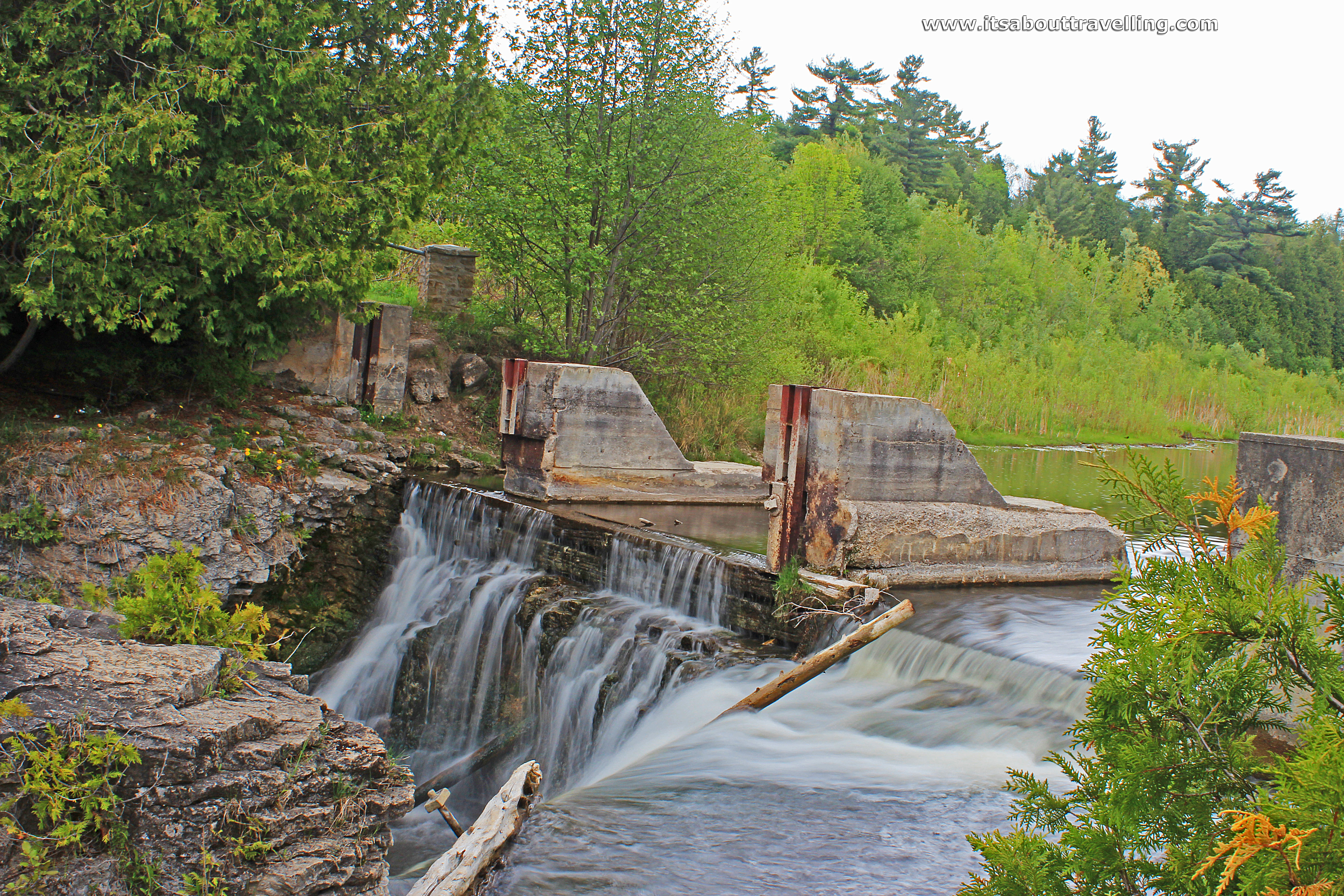
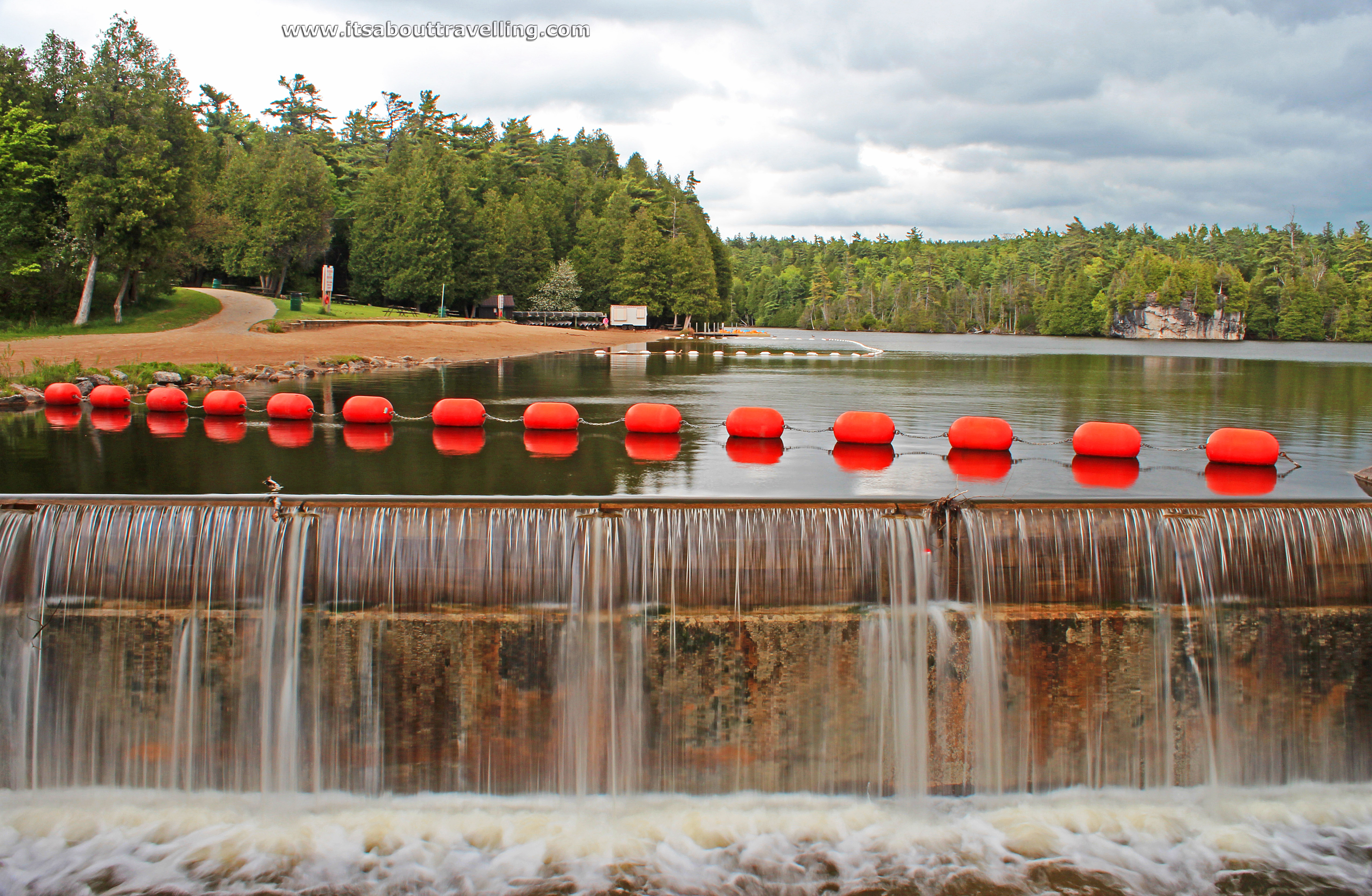
Above and below is the upper dam that was once an integral part of the Harris Woolen Mill.

The park has been open to the public since 1963. There are 105 campsites (45 serviced, 16 with full service, 43 unserviced). Per night, camping ranges from $38 to $54, depending on site size, site location and when visiting. To get in for the day, adults pay $6 while seniors get $.75 off and kids 6-14 pay $3.
There is a beach to swim at. However, like all lakes in Southern Ontario, its likely bacteria levels will cause the swimming area to be closed often during the warm summer months. If you see the Canada Goose population, you’ll know why.
The lake is stocked with Brown Trout. Largemouth Bass, Smallmouth Bass, Carp and Bullhead survive naturally, as do the kiddy fish like rock bass and sunfish.
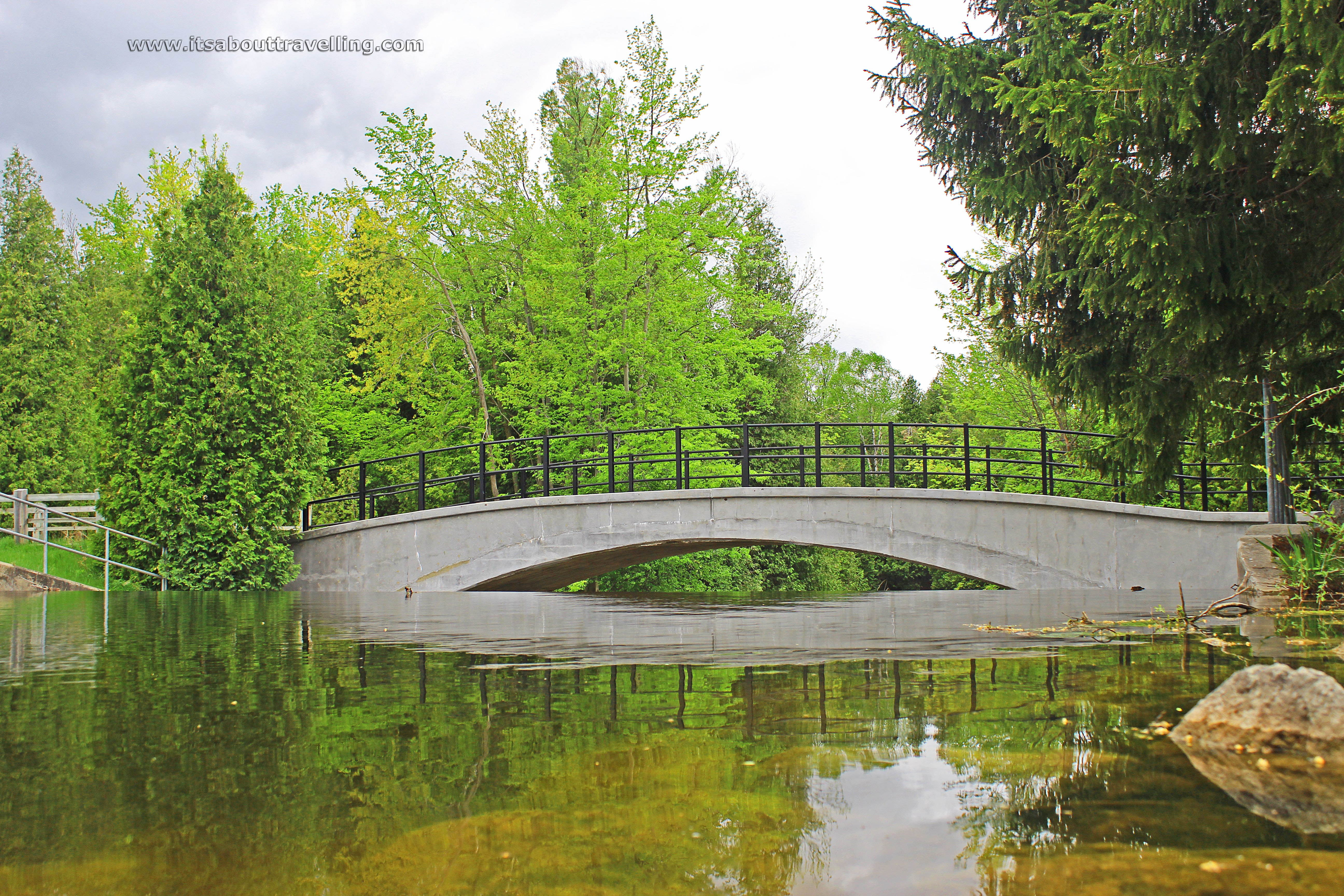
Above is the bridge over the lower dam at the western end of the park.
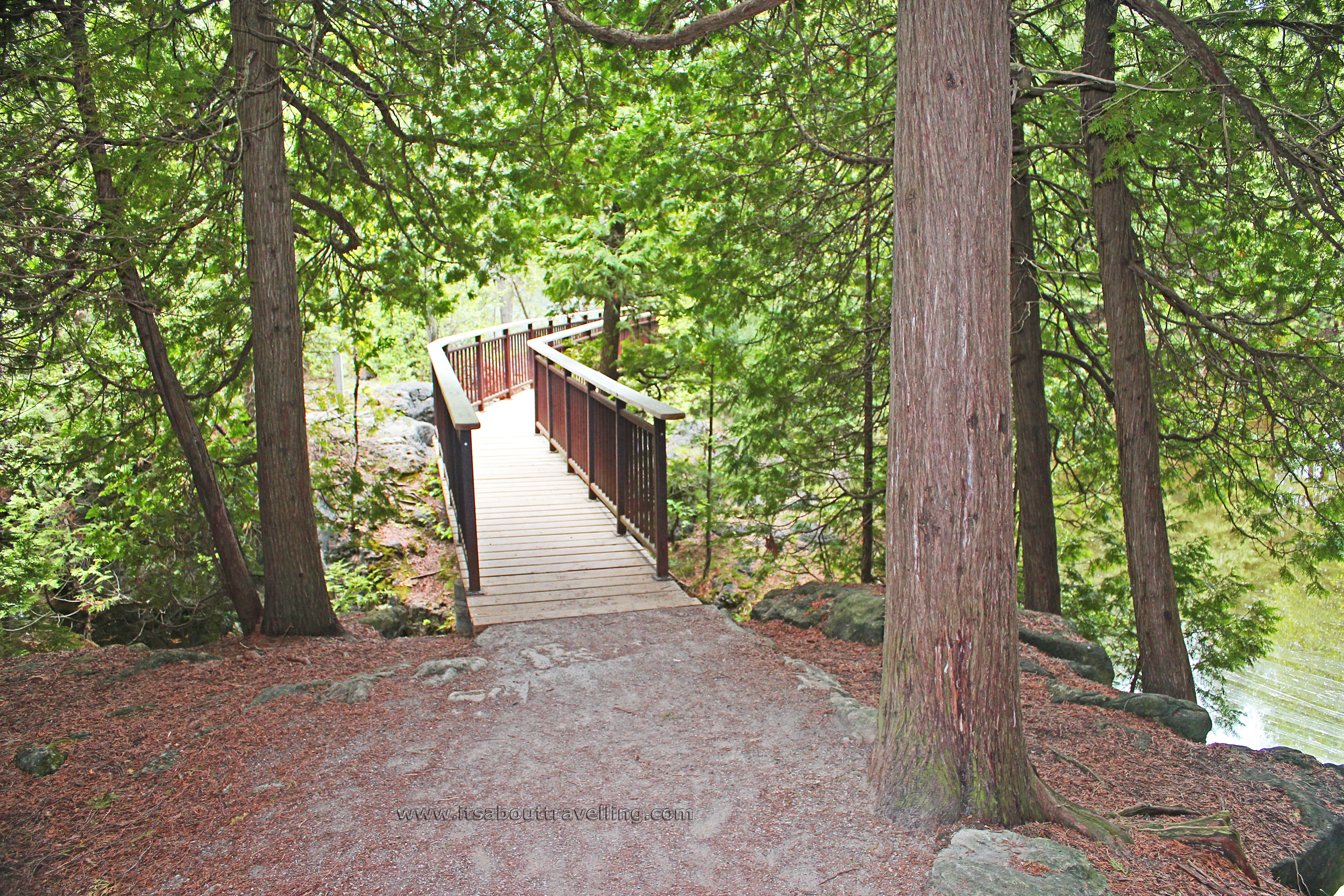
Hiking trails circumvent the lake. On the far side, it is called the Cedar Ridge Trail and takes walkers up to the top of the ridge, away from the water. Here, you will see just how remote the park is not as the trail runs near farmland and residential property.
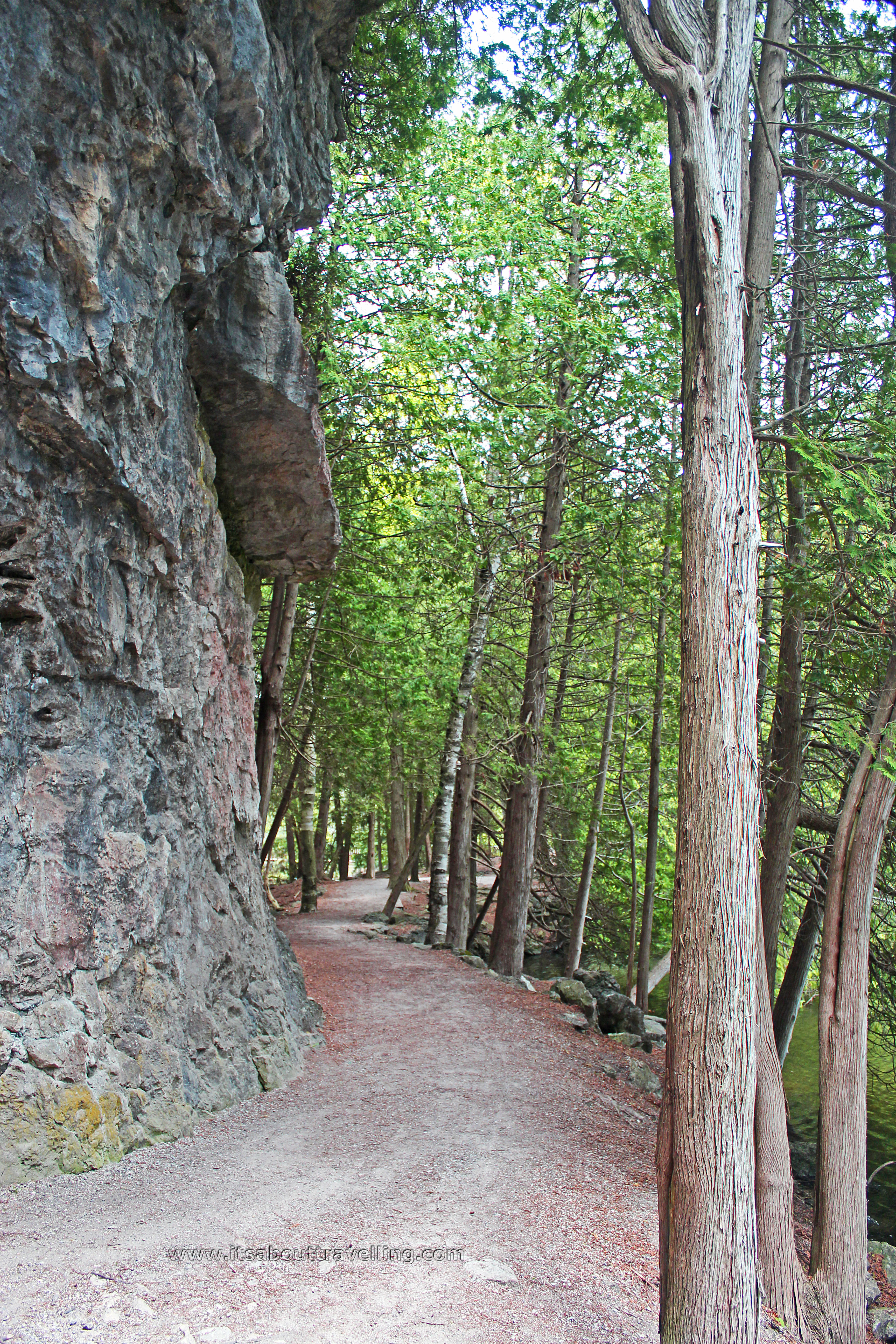
On the campground side of the lake, the trail is called the Pothole Trail. This was the playground of my youth. Today, visitors are strongly urged to stay on the trail because of major environmental damage. This damage is clearly evident and, if you do visit on a warm, sunny Saturday or Sunday, you will know why. The place can become a human ant farm.
The trails have a little bit of a strenuous climb at times but the surface is smooth and more or less paved. I pushed a stroller around the full circumference and no difficulties whatsoever. This means that it would also be accessible for wheelchairs.
One feature that I always seem to miss is the caves. There is a cave system in the park, upstream from the old mill dam. There is a series of 12 caves that are some of the most extensive in Ontario. Inside, there are stalactites and stalagmites and it is deep enough to necessitate a flashlight.
When visiting Rockwood, you really should consider also visiting the Halton County Radial Railway. It’s just around the corner, a short drive down Guelph Line, and makes for a fun, nostalgic experience.
Below is a HD video from clips taken on the same day as the images above. If you like what you see, please give a ‘thumb’s up’ in YouTube. If you love what you see, please share with friends!
Rockwood Conservation Area Video

