

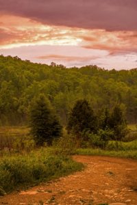
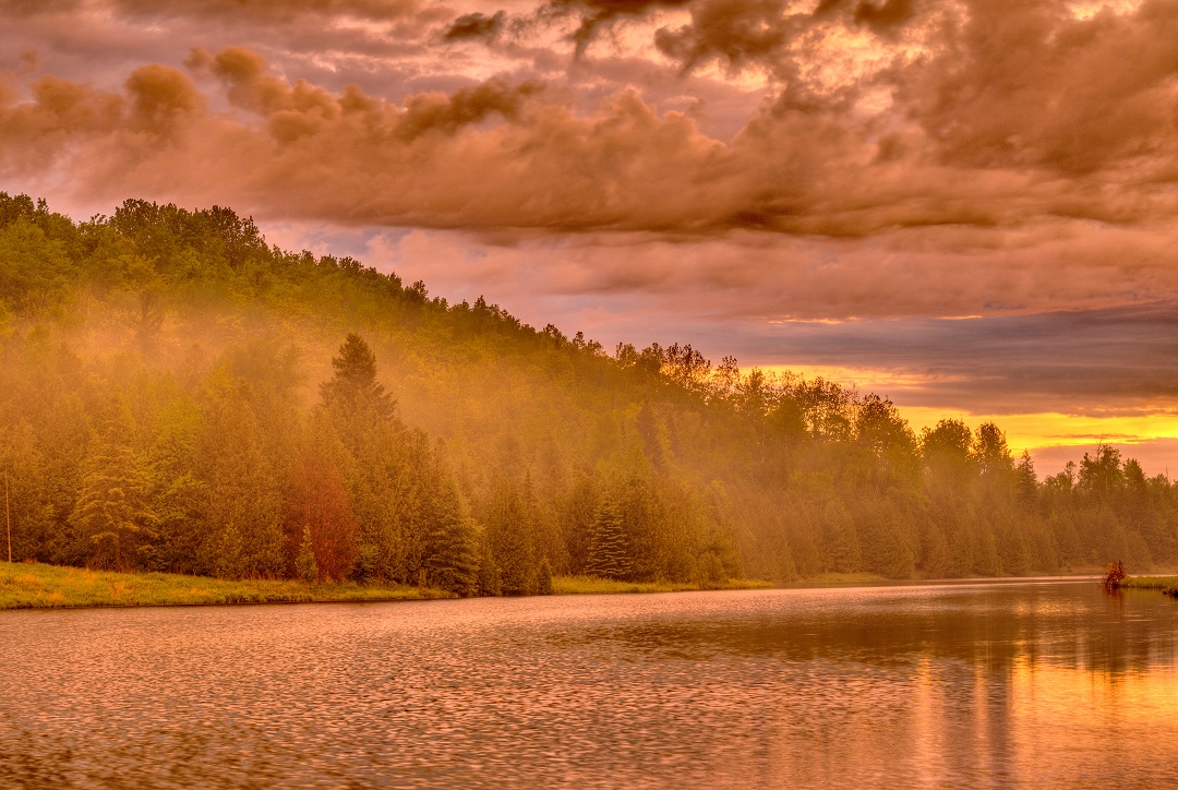
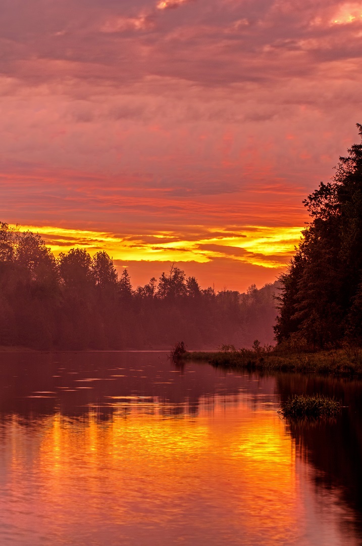
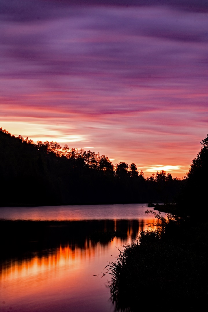
You just never know what you’re going to get. But, if you don’t get out of bed, you get nothing. It wasn’t supposed to storm on this morning at Pine River Provincial Fishing Area. The sun was due to rise directly at the opposite end of this dammed up section of river.
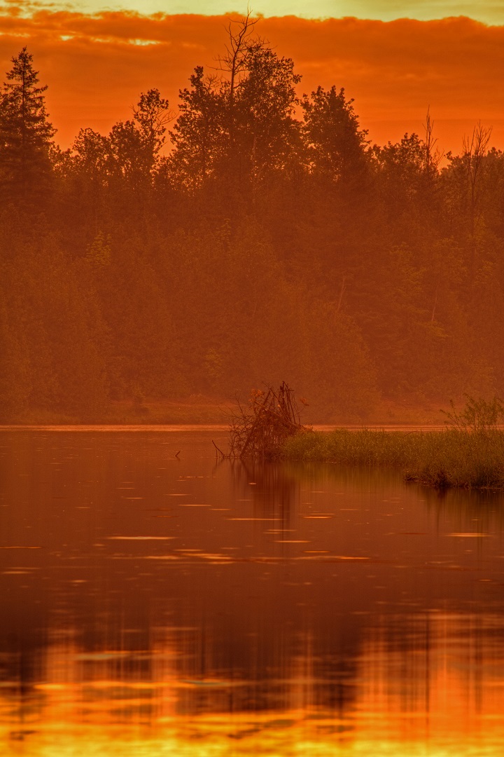
The sunrise was beautiful. Then, the flashes came from the opposite direction. This mix actually made for a surreal orange glow to the landscape. The photos in the gallery below have been enhanced little for colour.
I got to the car. The light was gone and the rain came down in buckets. That was it. Not even 30 minutes of glory in exchange for getting up at 4:00am. I did continue on to nearby Boyne Valley Provincial Park to capture some video of the trails. That video is included below.
Pine River Sunrise Image Gallery
The following photos have been cropped to fit the gallery format. For full-size versions, simply click on the individual pictures.


High resolution versions of these images and other photos from the same day are available at Dreamstime. Want to earn cash from your own photos? Why not sign up for free with Dreamstime and start submitting now: Become a paid photographer!
Pine River Again?
Yes, we’ve featured this location several times before at It’s About Travelling. However, this is the first good sunrise visit. Some of the best photos involved standing in the actual river, just a few feet below a beaver dam under construction. If you know the temper of a beaver, you know this might have turned out bad.
The non-operating property owned by Ontario Parks is located on River Road, just west of where Prince of Wales Road ends in Dufferin County. The Bruce Trail runs through the east end of the park and definitely provides some nice scenery.
The beavers are just doing their job but have wreaked havoc at this location over the years. The dam was formally about 100 feet upstream before the Ministry decided to bust it up. In a form of revenge, the beavers started their new dam right at the point where anglers gather and ATV’s cross to the other side. No doubt, as this area gets flooded, the new dam will be destroyed. Where will these critters go next?
Boyne Valley Provincial Park Trail Video
Later that morning, I hiked in through the remnants of the downpour and recorded the return journey through Boyne Valley Provincial Park via the Bruce Trail. The highlights of the trail are the actual crossing of the Boyne River and the view from Murphy’s Pinnacle.
If you like the video, please give it a ‘Thumb’s Up’! We would be forever grateful if you’d subscribe to our YouTube Channel…
Video edited with Corel VideoStudio Ultimate 2018.

