
This web site started nearly three years ago with the first article published on August 7, 2011. Not long after, we published an article on Onaping Falls (link goes to original article). It was August 22, 2011 and it was the fifth article ever posted at It’s About Travelling. In fact, the idea for the web site was basically hatched just days before while on a camping trip to Wakami Lake Provincial Park.
On the way to Wakami Lake, we stopped for a break at Onaping Falls. The waterflow in August is much different than the third week of May. When we first visited, there was lots of scrambling that could be done along the rocks at the sides of the waterfall. There were even spots where you might even be able to get across through the water.
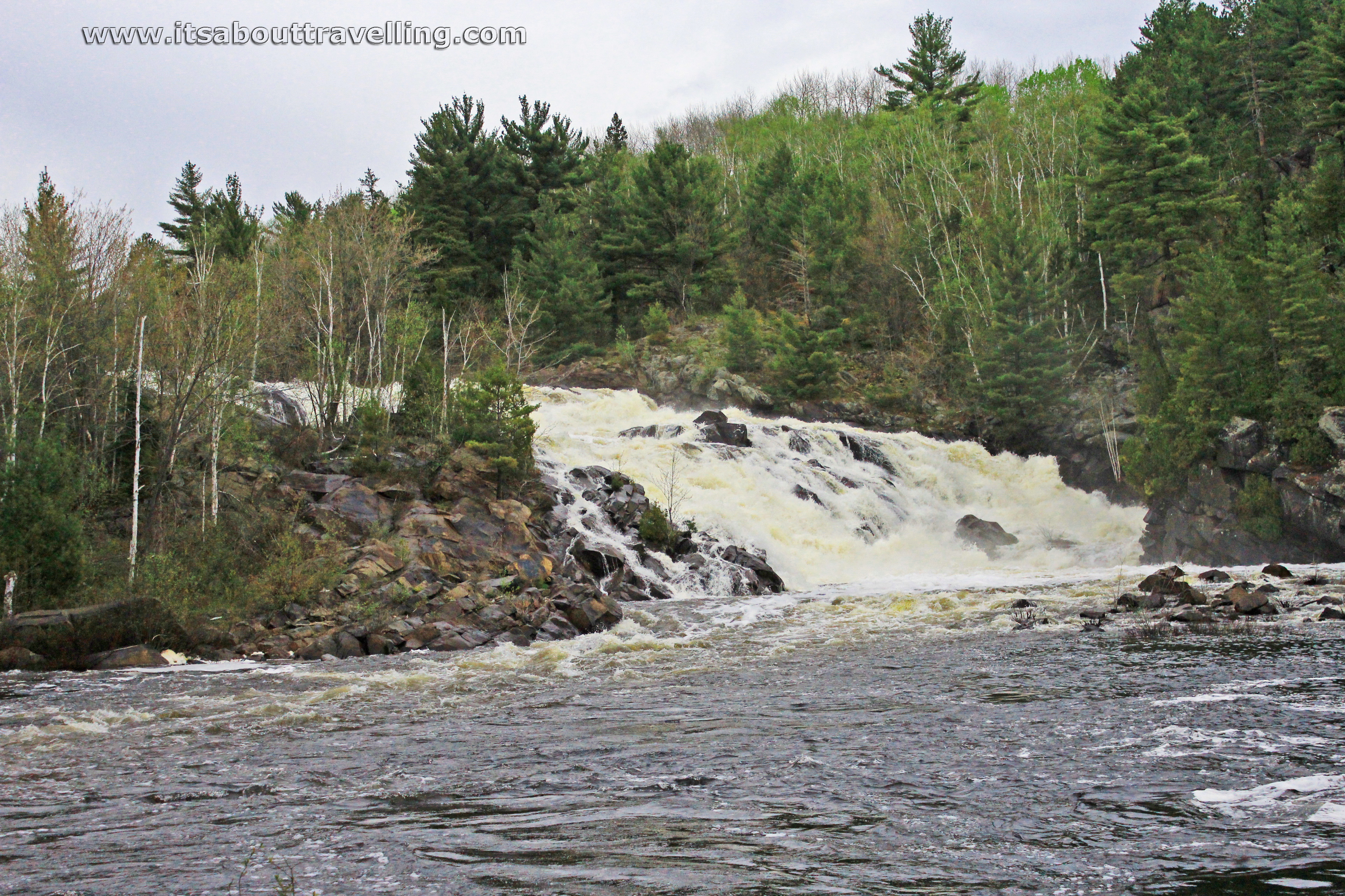
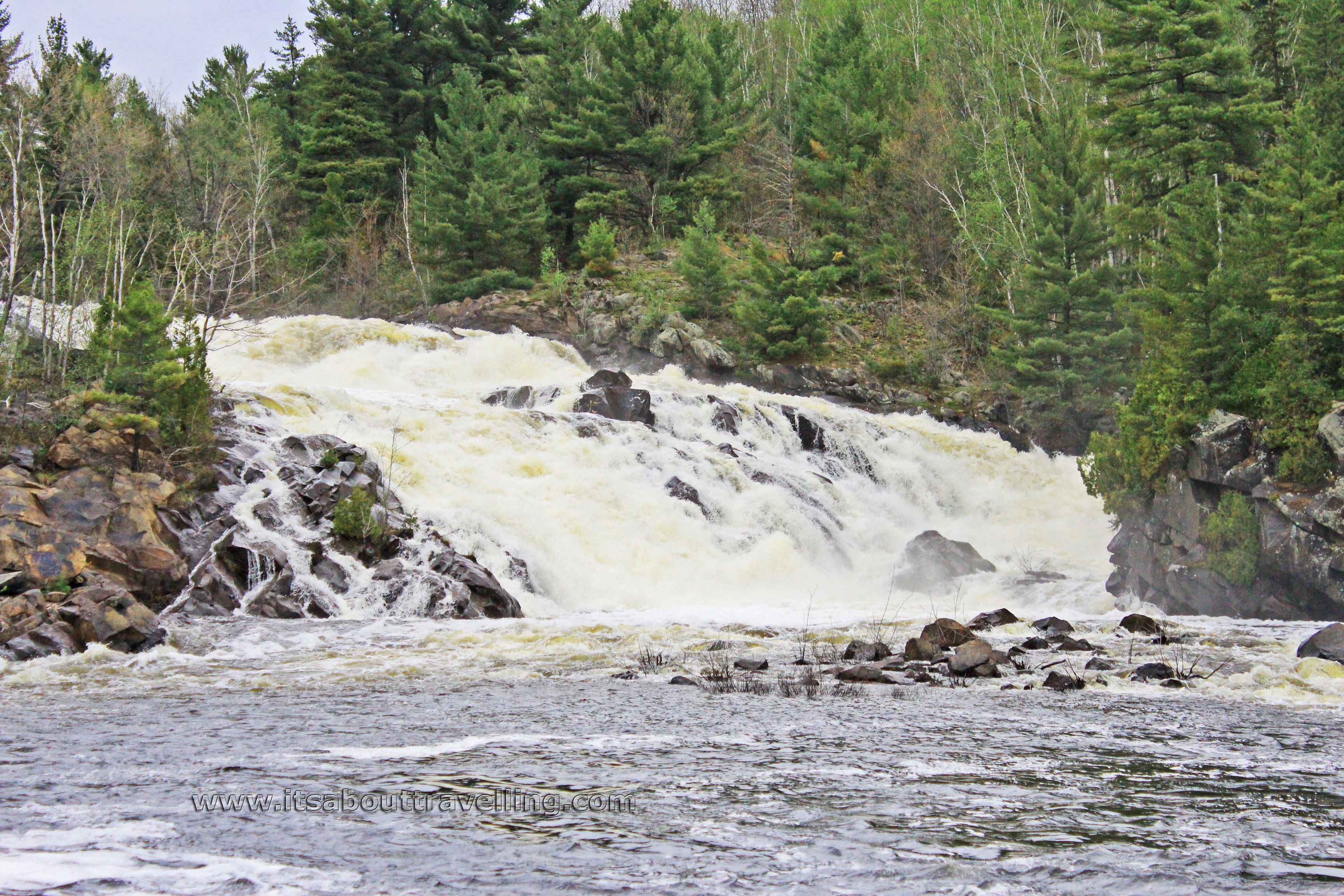
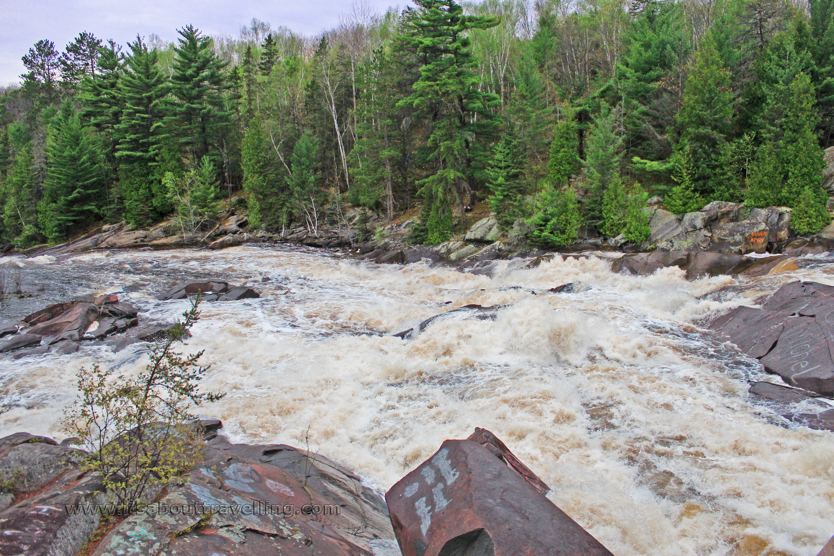
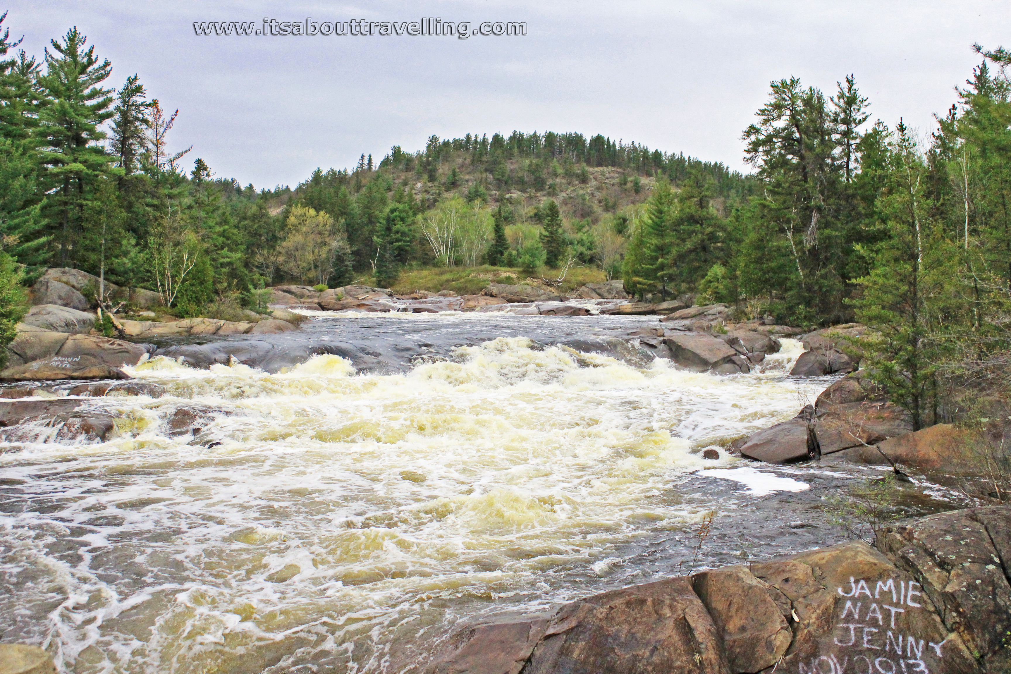
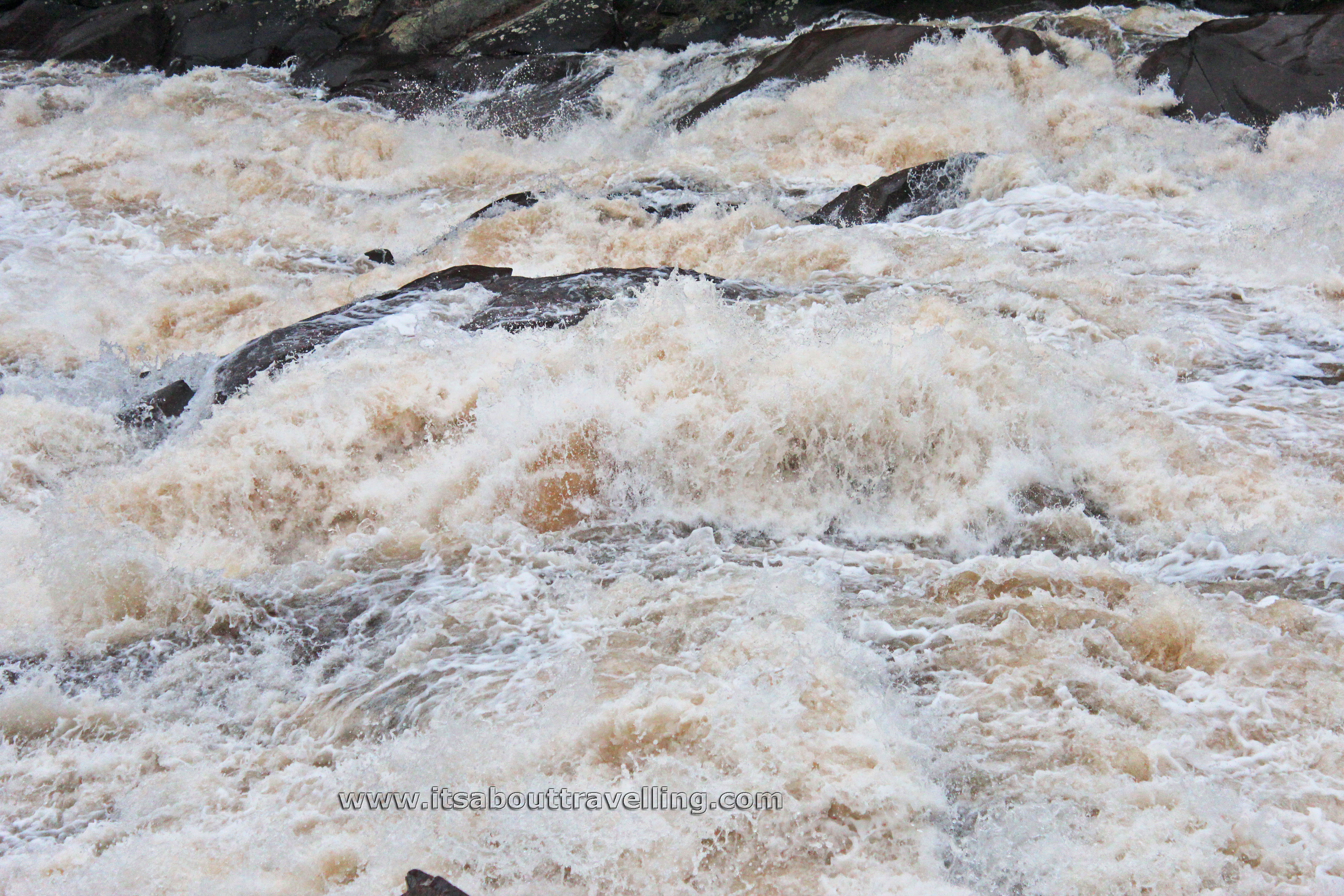
Not so in May. The Onaping River was still a raging torrent fed by the heavy snow and late melt from the winter of 2013-14. Much of the rock surface that we climbed on three years ago was still under water this past weekend.
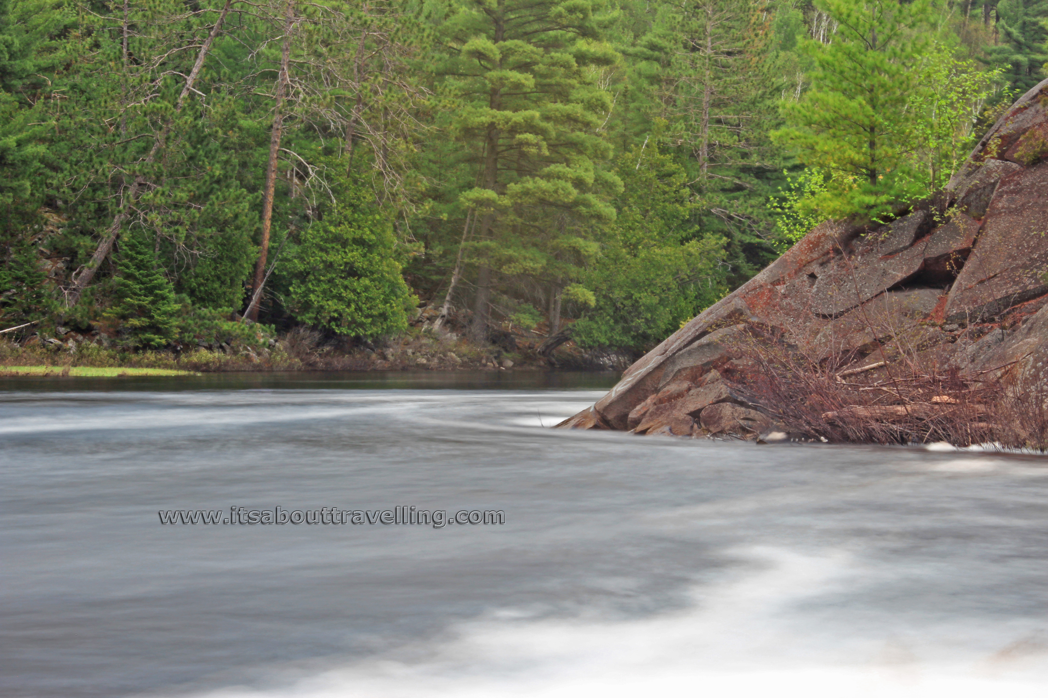
Looking back, that weekend in August, 2011 was the first time we used the Canon Rebel T3i that I still shoot with today. Although my photography skills are still in their infancy, the long exposure water blur image above was completely outside my realm in 2011.
Onaping Falls
So, what is Onaping Falls? This is a waterfall on the Onaping River, just north of the town of Dowling, Ontario and right alongside highway 144. Hwy. 144 is a lonely route that runs from Sudbury to Timmins, around a 300 kilometre stretch of highway with not much civilization along the way.
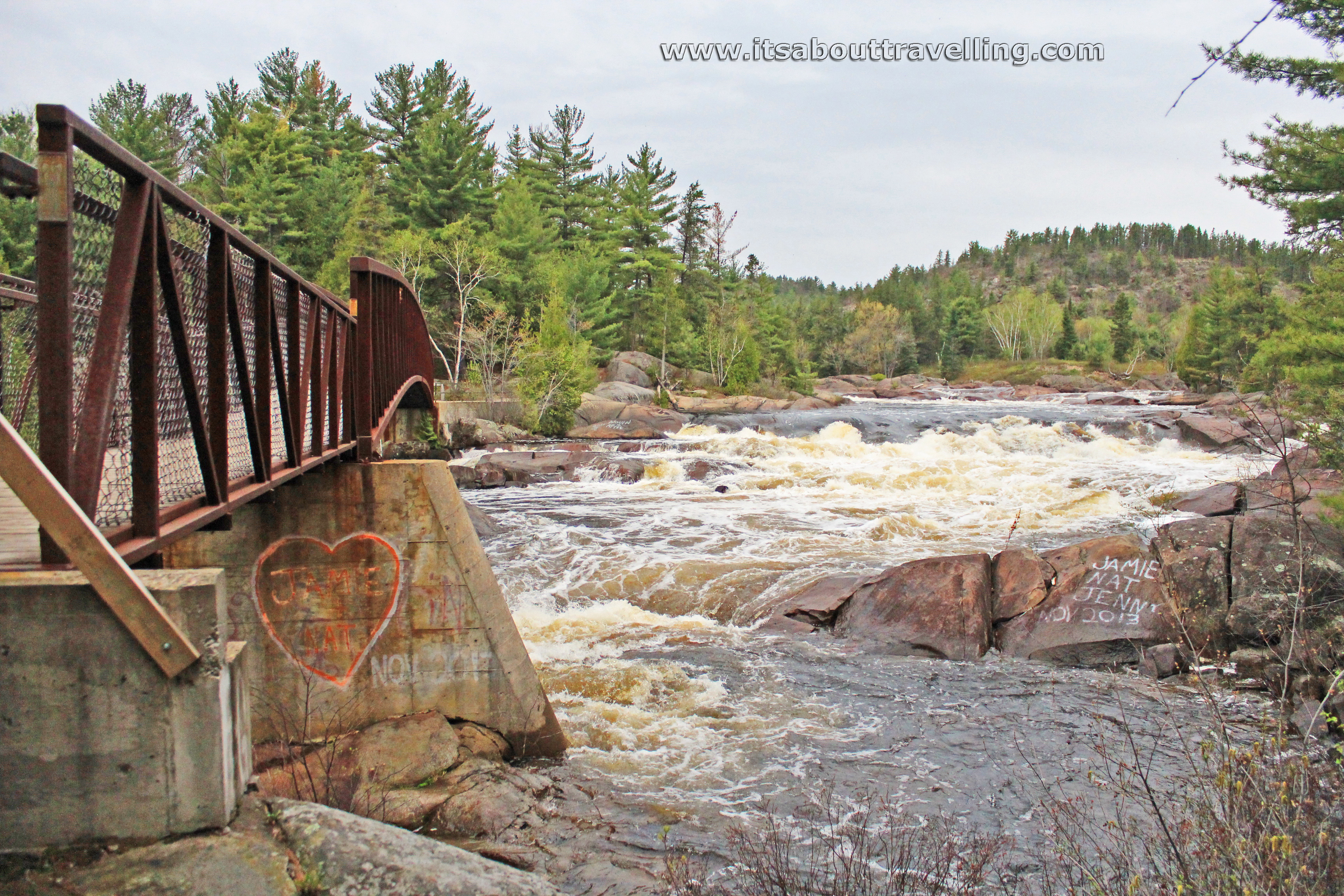
The waterfall is about 35 km up the road from Sudbury. There are claims that the total drop in elevation from top to bottom is 150 feet. Using Google Earth, that number is more likely around 85 feet. Onaping Falls consists of several drops over a distance of around 336 metres. The highest single drop is around 30 feet. A good portion is more like extreme heavy rapids that a waterfall.
Distance across varies along that 336 metre stretch and is affected by the season and amount of rainfall. Typically, the distance across is anywhere from 25 to 50 feet.
I believe I said this previously but I’ll say it again, Onaping High Falls is one of the top attractions in the area and the fact that it’s void of fees and relatively void of human beings is a huge bonus. It’s meant to be a road side rest stop, just like Muskoka High Falls (link takes you to a video we shot there last summer) – another waterfall that we previously featured here, but in reality you could spend the better part of a day exploring the trails and rocks.
For hack photographers like me, Onaping Falls is one of those waterfalls that just does not do well with long exposure water blur effects. To best capture the power of this torrent, jack up your shutter speed as high as it will go and freeze frame that water.
For trainspotters, there is an added feature of a CN freight line that intertwines with the highway. Over the three times I’ve visited this site, I’ve never gone without seeing at least one train. This past visit, three passed by in a relatively short period of time.

It should be noted that there are two lookouts near the washrooms and picnic area that are wheelchair accessible. However, the trail that goes down to the base of the waterfall and then back up the rocks to the walking bridge at the crest is not. If it’s raining, this trail can be a bit difficult as the rocks are rarely flat and do get quite slippery.
The HD Video below was taken the same day as the above images and really captures the power of the waterfall from several different vantage points. Check it out, switch to HD if your computer and internet connection can handle it. Don’t forget to give it a thumbs up!
Onaping High Falls Video

