
The Northwest Territories is a very, very large place. It spans from the 60th parallel all the way to the North Pole. In July, 2016, we traveled to the territory and drove through just a small portion. Yet, it was a major accomplishment and we were planning our return trip right after crossing the border back into British Columbia.
Keep in mind, early July in the Northwest Territories is a completely different world than if you visit in winter. Although, some prefer the winter in order to see the spectacular ‘Northern Lights’. In July, you will not see the Aurora Borealis. You will not even see a star. The sun doesn’t go down for long and the darkest it gets at night is a twilight. In fact, you can still read a book around the campfire well after midnight.
There are so many things to see in the Northwest Territories, regardless of when you visit. We crossed in from Alberta and did what some call ‘the loop’. We traveled north and west on highway 1 (aka The Waterfall Route) until the junction with highway 7 (aka The Liard Trail). We then traveled 7 west and south to the border with B.C. We also traveled highway 5 to Hay River and Wood Buffalo National Park, as well as highway 3 in order to see the Deh Cho Bridge. What that means is we traveled on about 90% of NWT’s highways.
Things You Will See In The Northwest Territories
Here are 19 things that you are virtually guaranteed to see on a summertime road trip into Canada’s Northwest Territories. Click on any of the images for the full sized, high definition version.
1. The Welcome Sign At The Border

At the welcome centre, you’ll have a much friendlier greeting. Here, the great folks will give you all the information you need for time in NWT. You’ll be given the really important info like where to get gas and why you should be carrying cash, etc. Gas stations are few and far between. You can go literally hours on the highways without seeing another vehicle.
Cash? The stores are equipped with debit machines and there are ATM’s. However, if one goes down, it could be days before they’re back up as repairmen and parts have to come from a long distance away.
2. Wilderness Without Barriers

So, use common sense. Use your brains. There is no one to hear you scream when that special selfie goes horribly wrong and you’re swept to you death over a massive waterfall.
3. Bison
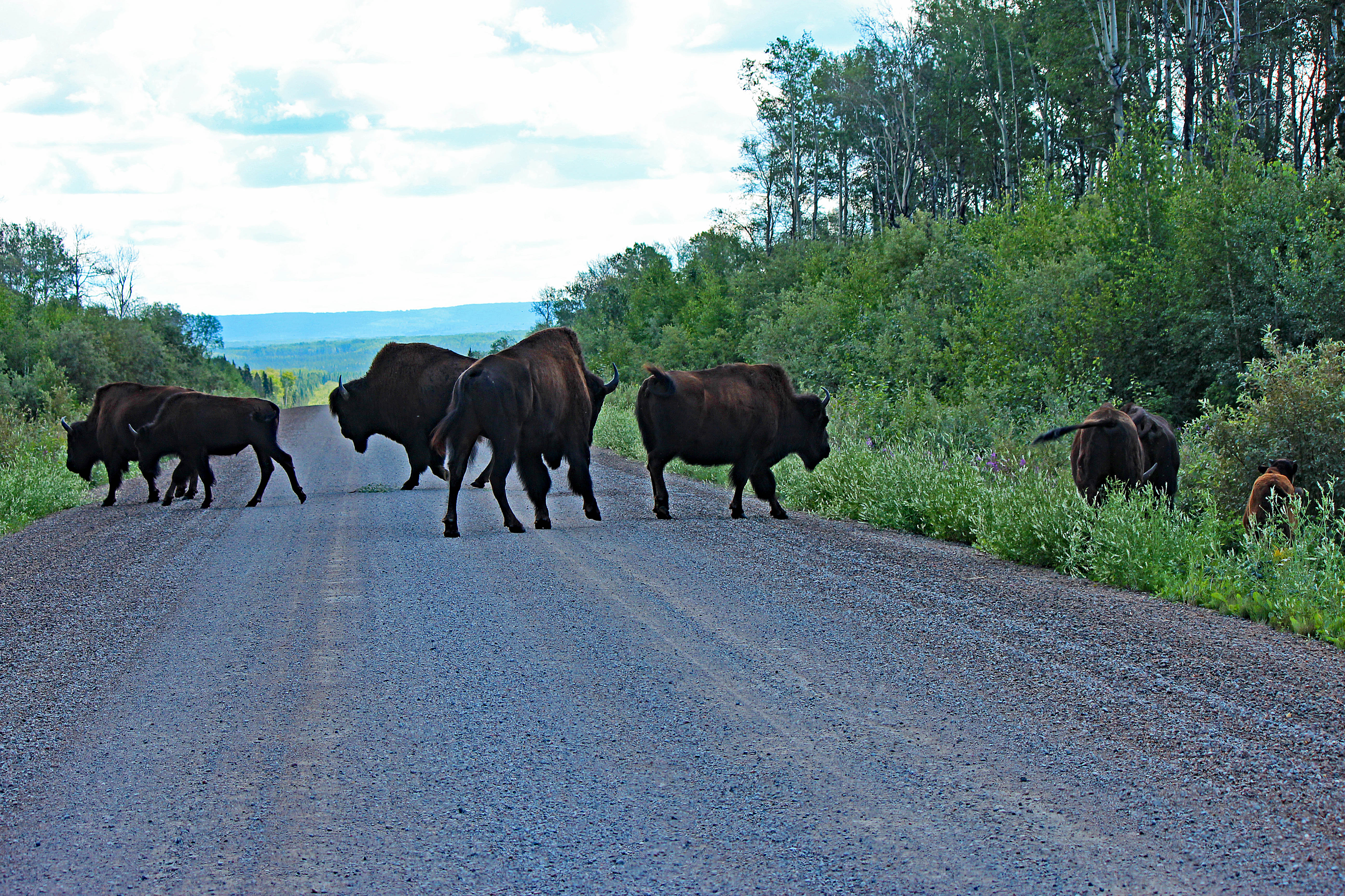
The funny thing is, we had a hard time finding any Bison on our trip. On the long road to Fort Smith and Wood Buffalo National Park, I saw one in the forest at the side of the road early in the drive. I could have and should have stopped, but didn’t. There would be so many more ahead, right? After all, we were going to a national park created to protect this animal.
Well, we didn’t see any at Wood Buffalo. We did see lots and lots of bugs, but no Bison. On our last night in the Northwest Territories, my son and I saw one right at our campground but my wife missed out on it. We were about to give up with about 20km left before the British Columbia border. That’s when, magically, we came over a rise and there was a full herd on both sides of the road and on the road itself.
They seem quite docile. But, when you’re on a road with no other vehicles within miles and these beasts are standing as high as the Honda Odyssey minivan, it’s a bit intimidating. The herd seemed to go for ever and what got me nervous is that there were several young. That meant to me that there were several concerned parents keeping a watchful eye on us.
4. Television Stars

More recently, this DC-4 starred in an episode of Ice Pilots NWT, along with an episode of Nova on PBS. The plane was also featured in the U.K. documentary Dambusters: Building the Bouncing Bomb.
5. Forest Fires
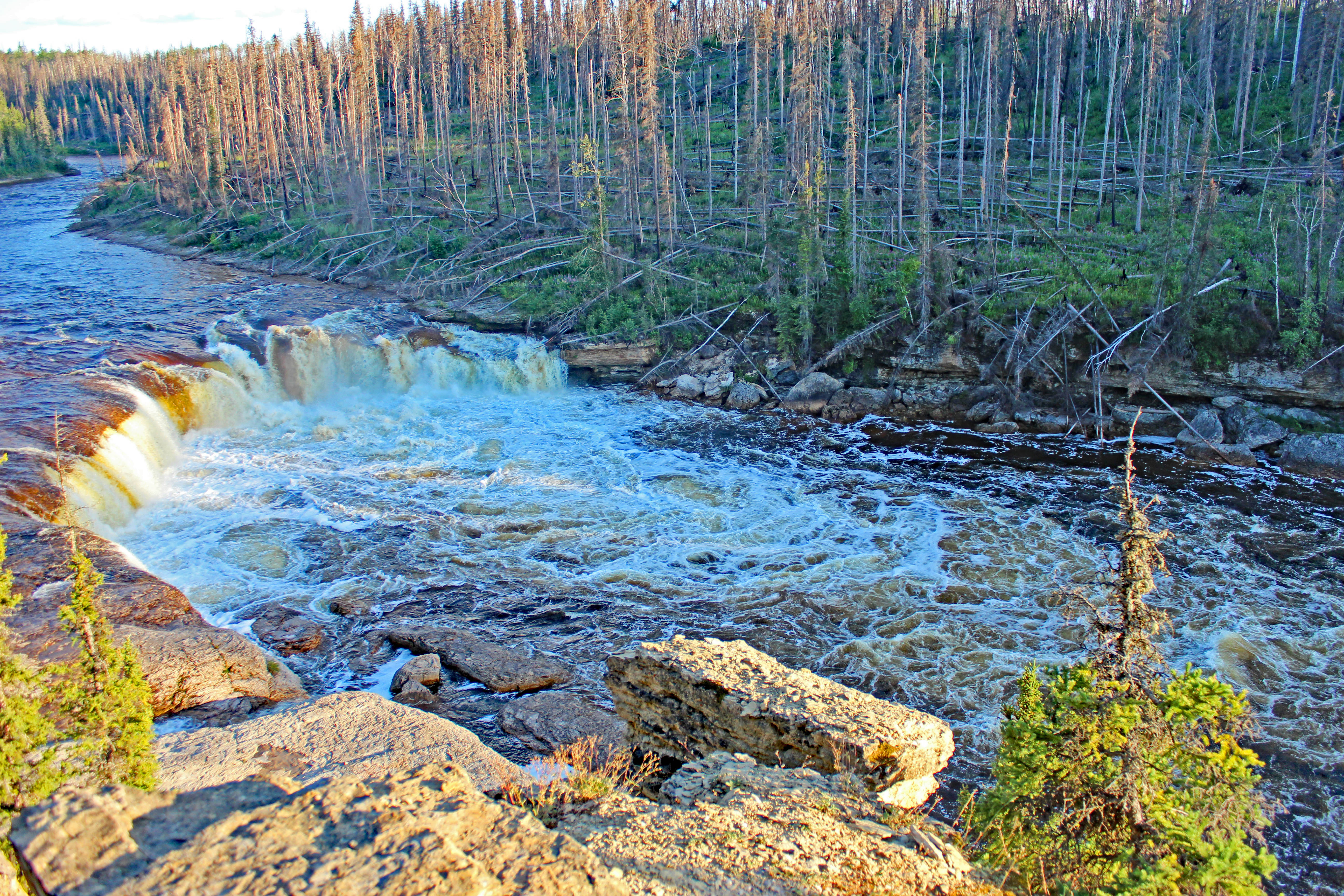
This is quite interesting because we went before the dust had even settled on the Fort McMurray fires of 2016. Fort McMurray was such a tragedy but the truth is, fires like that are an annual occurrence. It’s just that this time, it burned a rare populated area.
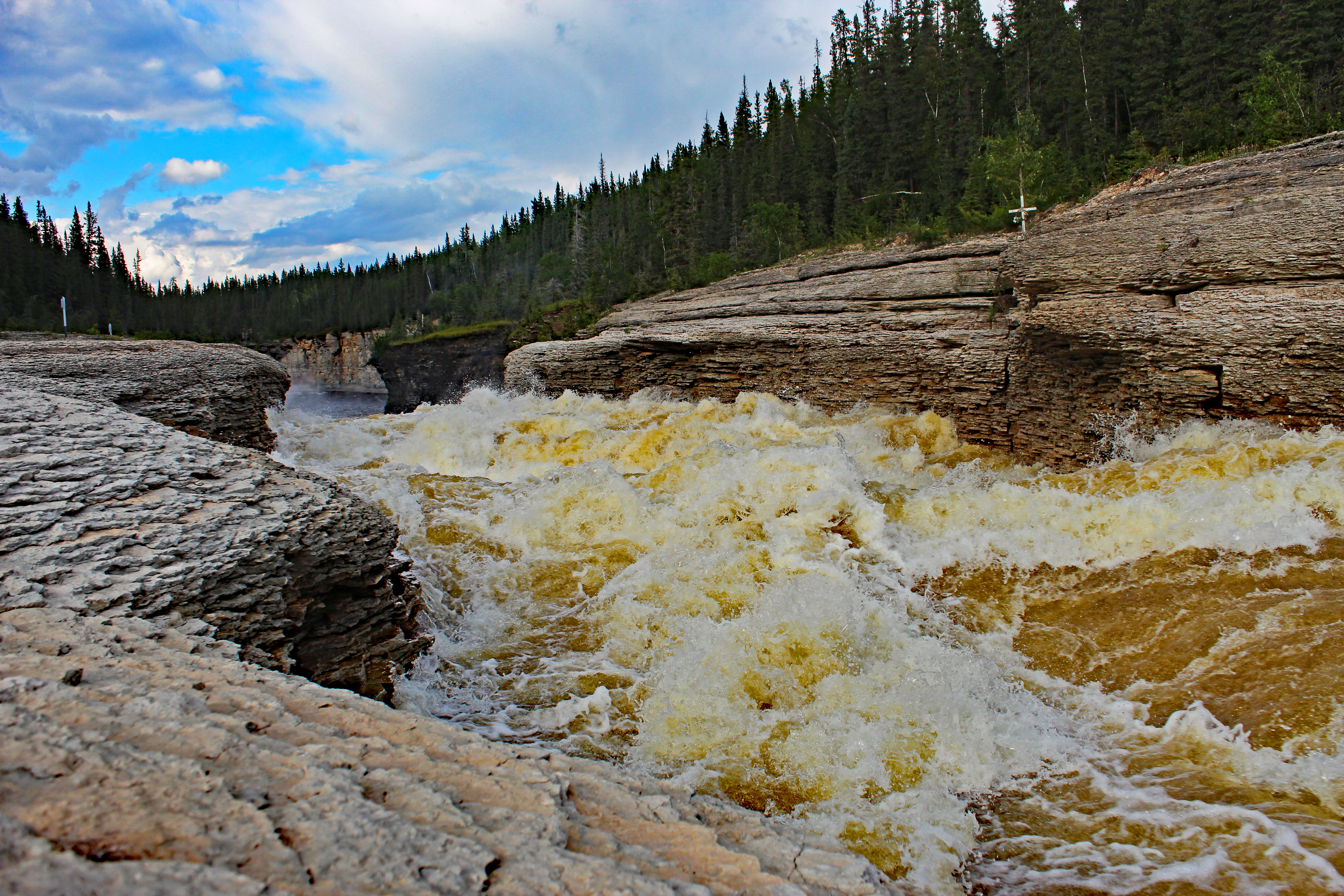
In the image it shows Coral Falls, just above Sambaa Deh Falls. On one side, the forest has been burnt out by fire. On the other, the forest is lush, green and seemingly untouched. This seemed to be often the case where rivers where the natural barriers for great fires.
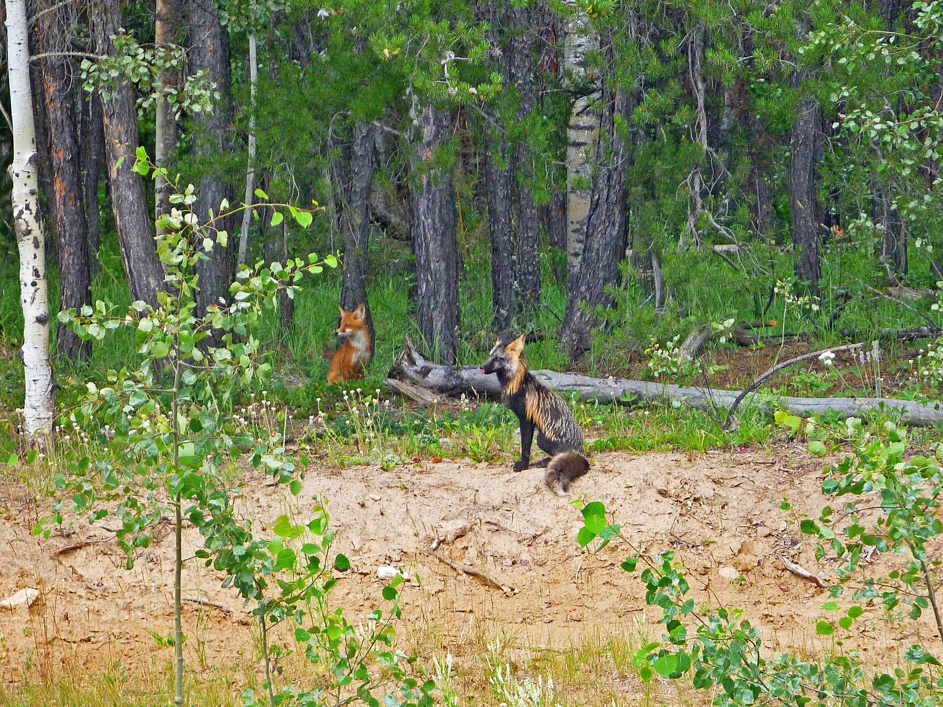
6. Cross Fox
7. Huge Rivers and 1 Big Bridge
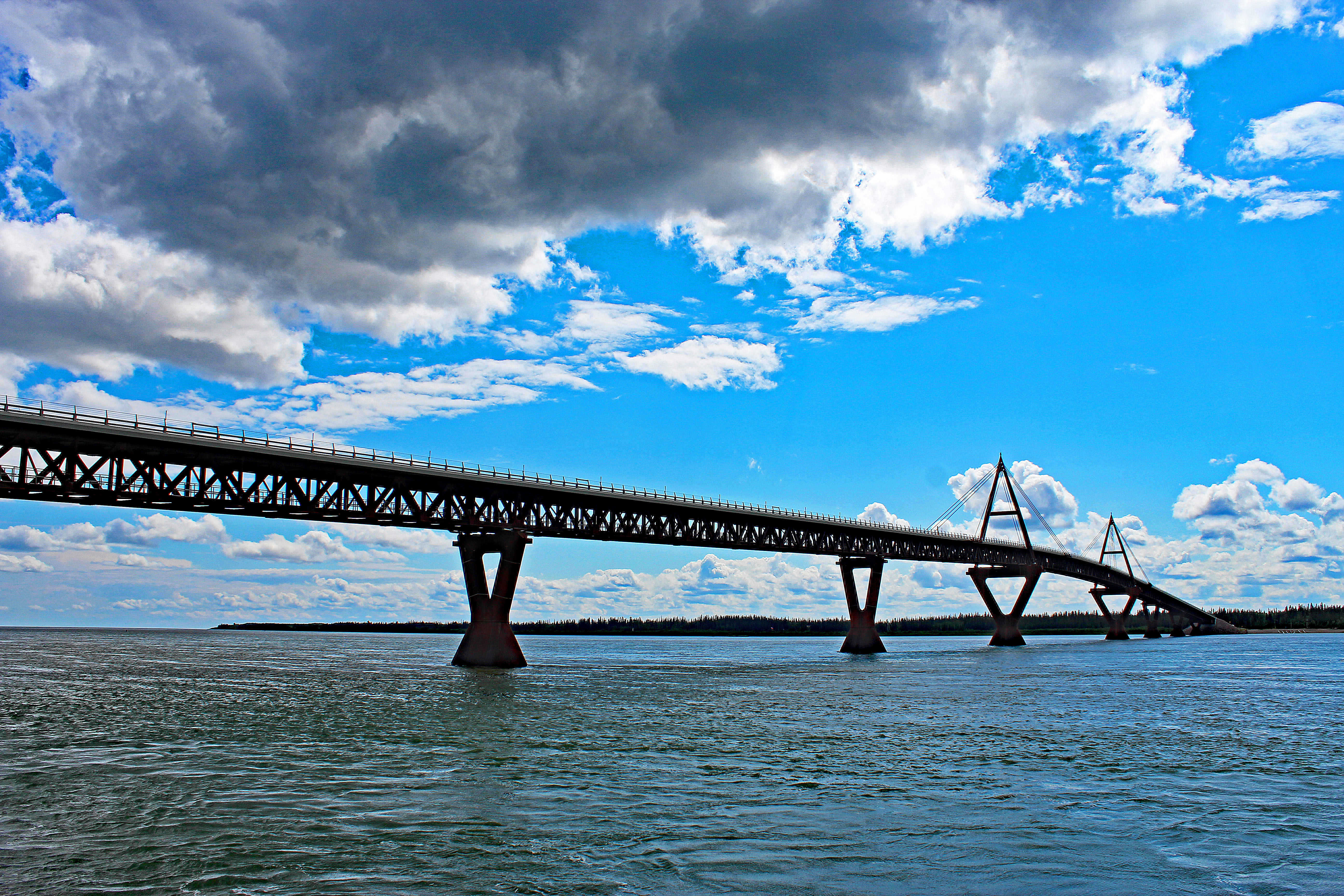
That is, until just a few years ago. The Deh Cho Bridge was built across the MacKenzie River at Fort Providence, giving a stable connection for the capital Yellowknife to the outside world.
8. Beaches
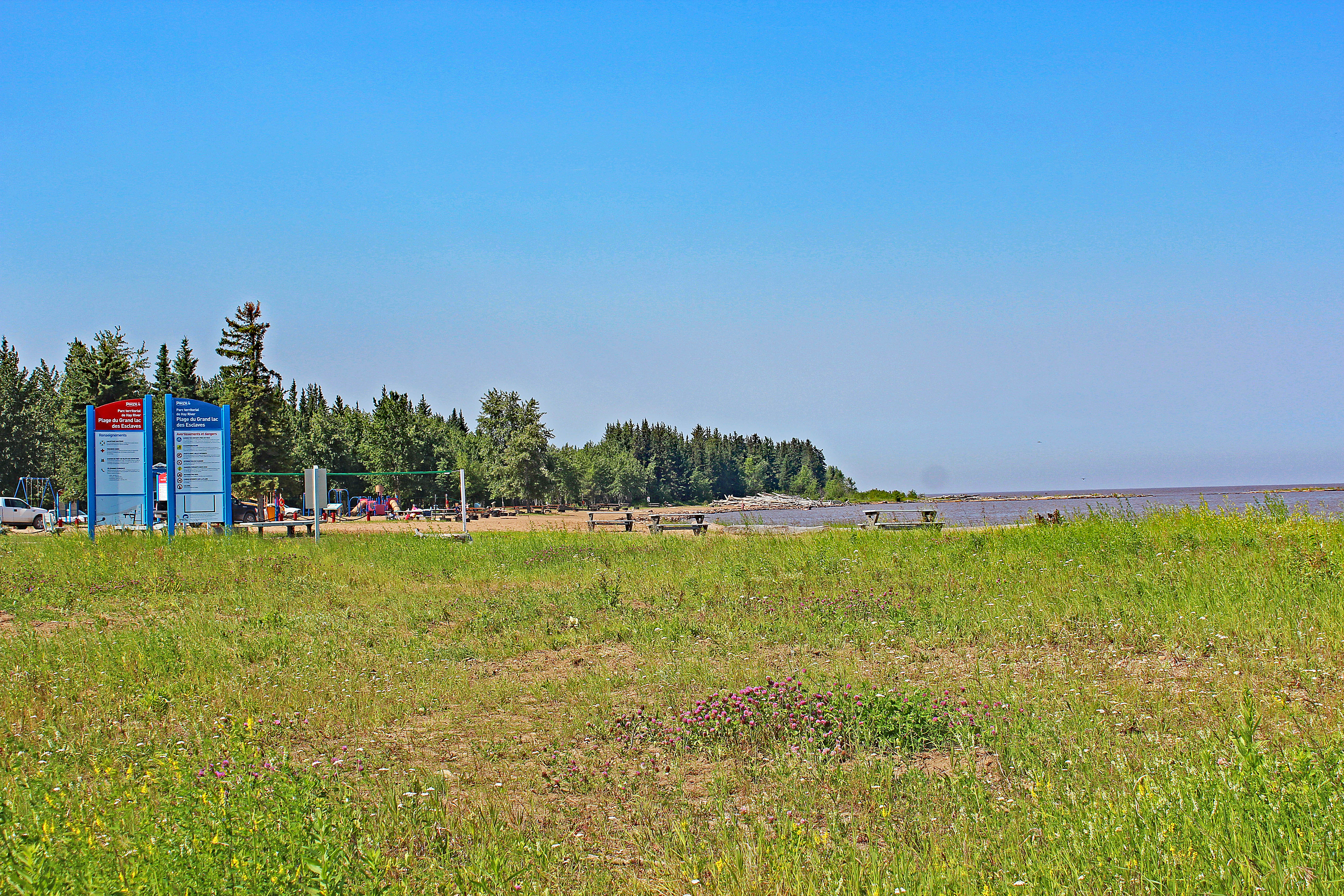
There is a campground here, as well. Hay River Territorial Park is further up the shore from the municipal beach shown in the picture. There are 35 sites in the campground, all powered and all spacious.
It’s interesting to know that Great Slave Lake is the second largest that is fully within Canada – remember that the Great Lakes share borders with the United States. Great Slave Lake is the deepest in North America with a maximum depth of 616 metres or 2,027 feet.
9. Rainbows
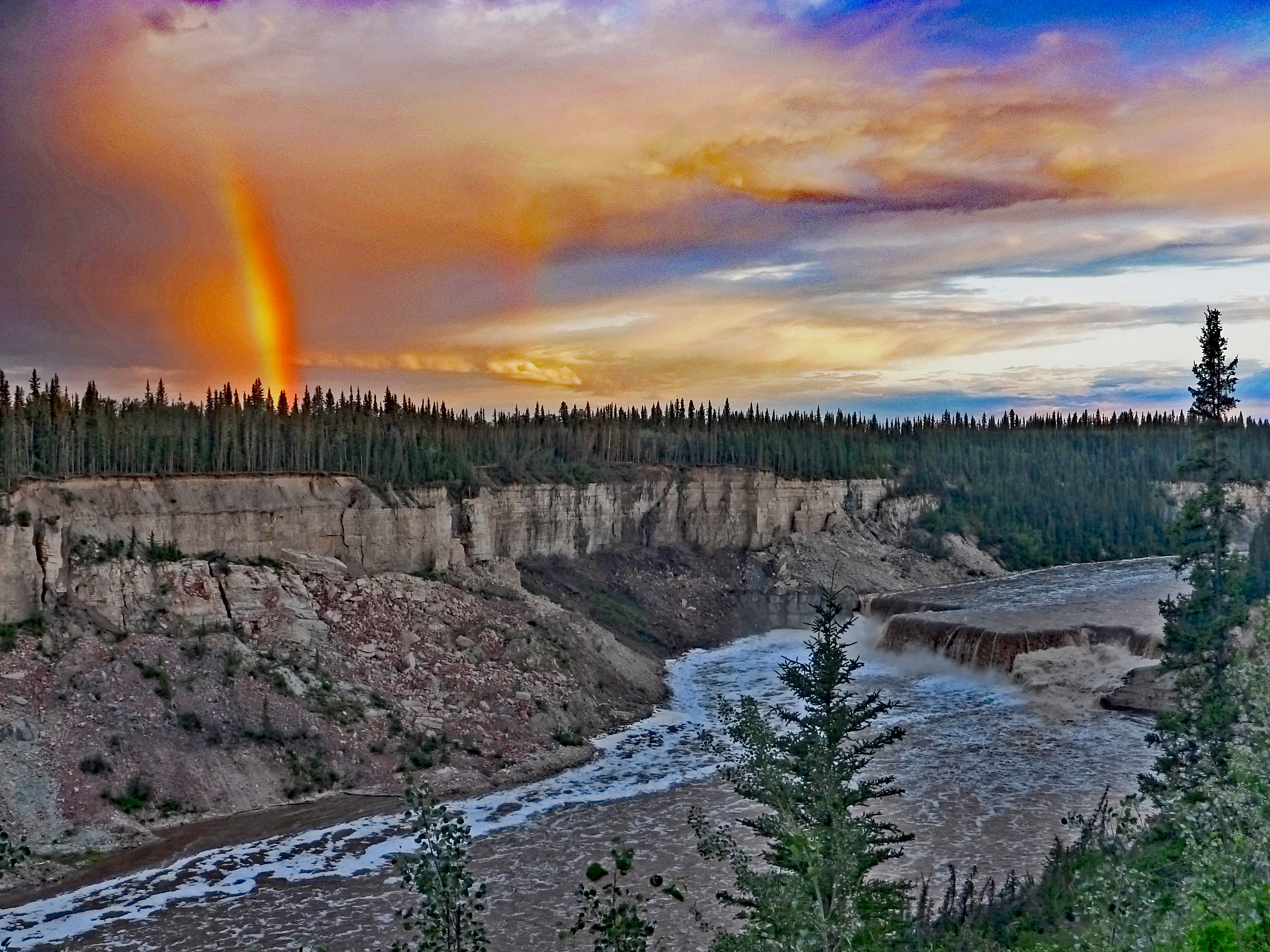
The waterfall below the rainbow is Louise Falls. Louise Falls and Alexandra Falls combine to be the highlights of the Twin Falls Territorial Park on Hay River.
10. Helicopters
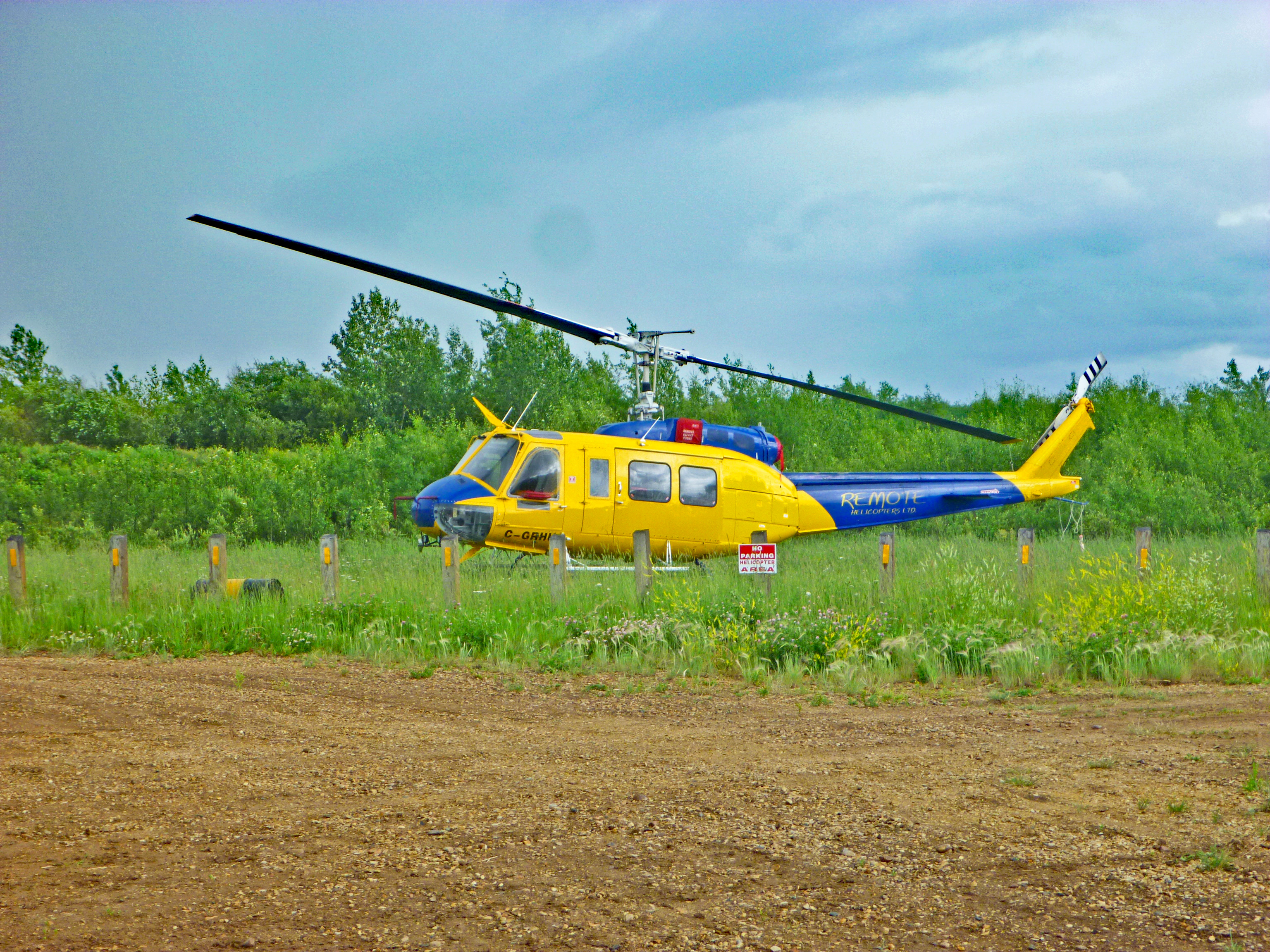
In the north, helicopters are simply a necessary form of transportation. Keeping an eye on forest fires or transporting workers to and from natural resources extraction projects, helicopters are nearly as popular as cars.
11. River Ferries

Ferry service was discontinued on the MacKenzie at Fort Providence with the completion of the Deh Cho Bridge. The ferry was still parked along the shore as a reminder of different times.
12. Mountains
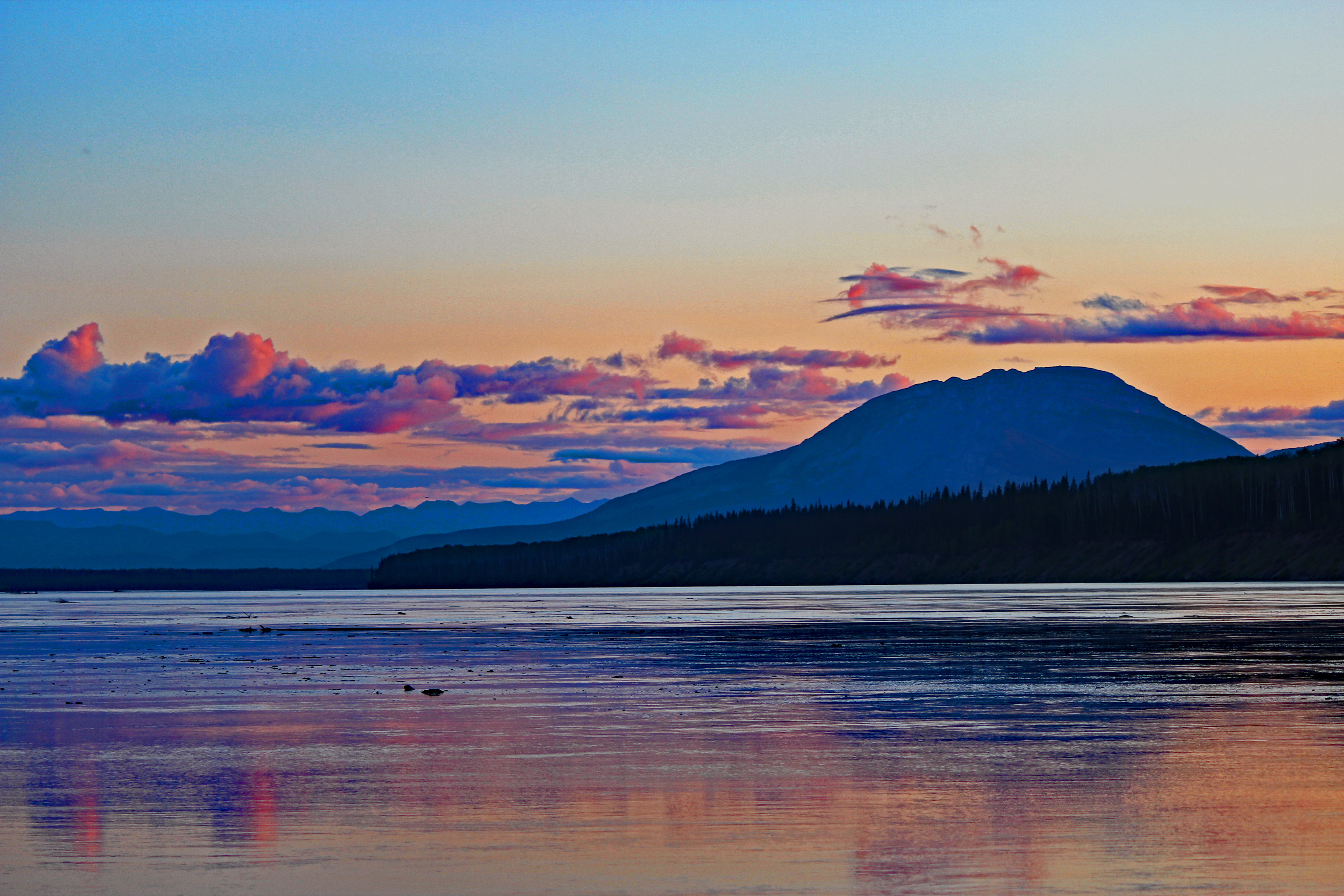
The Liard Trail (Highway 7) turns south and does not go into the mountains. However, you perpetually have the mountain scenery to look at for the rest of your journey south.
The image was taken across from the campground on the Liard River. If you click on the photo to see the full sized version, you will see that the river is littered with full grown trees that have been eroded from the shores upstream.
13. Bright Nights
At Louise Falls, there is a spiral staircase that takes you down the shear cliff to the edge of the waterfall. Even with the tree colour and the shade of the cliff, it was bright enough that there was trouble navigating the trail.
This, of course, wreaks havoc on your sleeping. Unless there’s a clock beside your bed, you really have no clue what time it might be. With a four year old and an eight month old baby, this can especially hard.
14. Gravel Highways

For the most part, highway 1 is entirely paved. Highway 5 is paved about half of the distance on the drive to Fort Smith. Highway 7 from the Highway 1 junction is not at all paved until about 10 kilometres from the British Columbia border.
However, that doesn’t mean the roads are not well maintained. Gravel or not, the roads are quite smooth. Dust is an issue but in places they’ve started working with some sort of dust control spray that does a great job.
15. Endless Sunsets
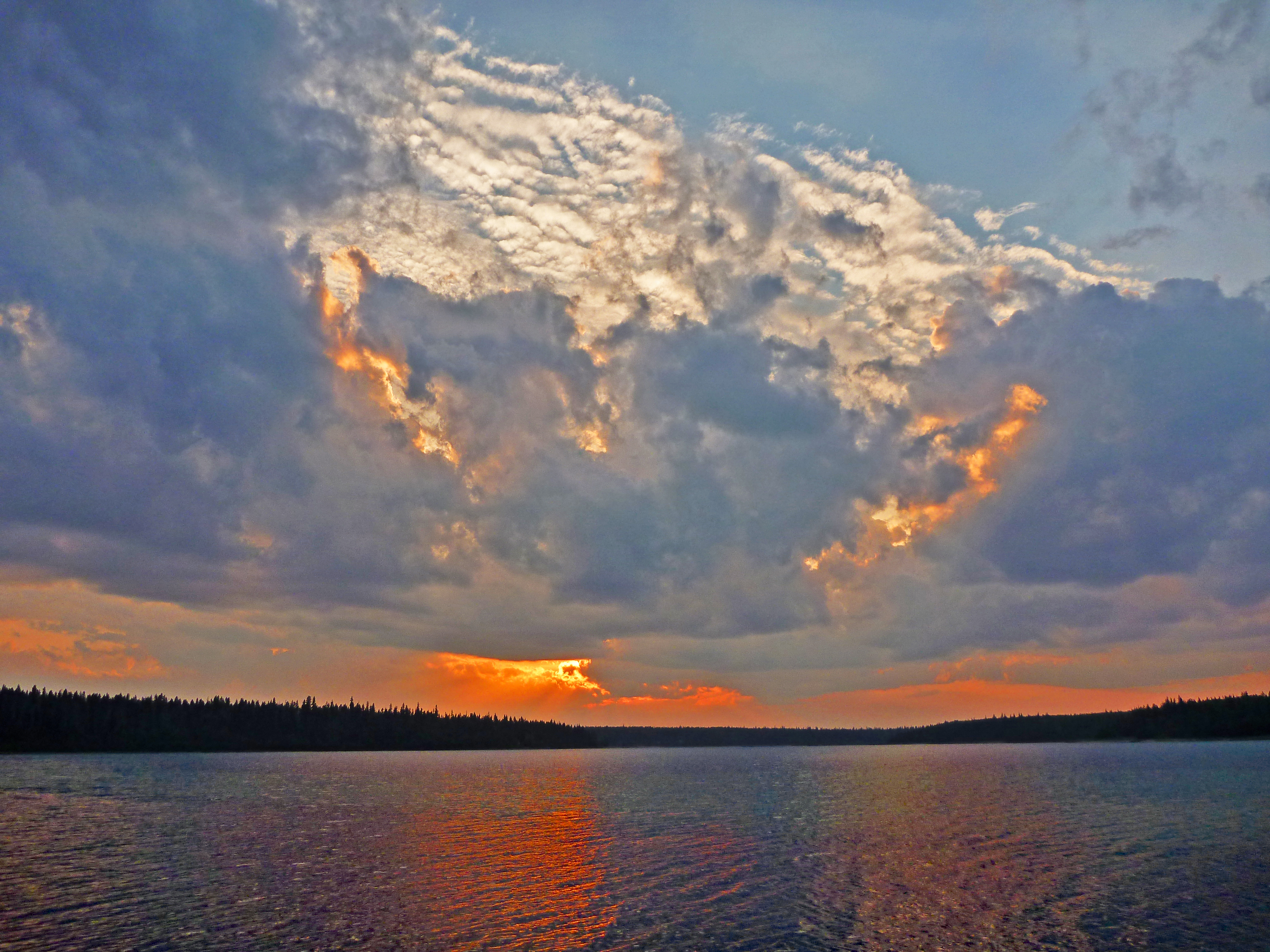
In the image, we’re actually not in the Northwest Territories. This is Pine Lake at the bug ridden campground in Wood Buffalo. The national park is both in NWT and Alberta. This campground happens to be in Alberta although it can only be accessed by road from the north and not from anywhere else in the province of Alberta. There was just one other site in use at this campground – a beautiful spot but nothing less than a constant invasion of mosquitos.
16. More Dirt Roads and Forest Fires
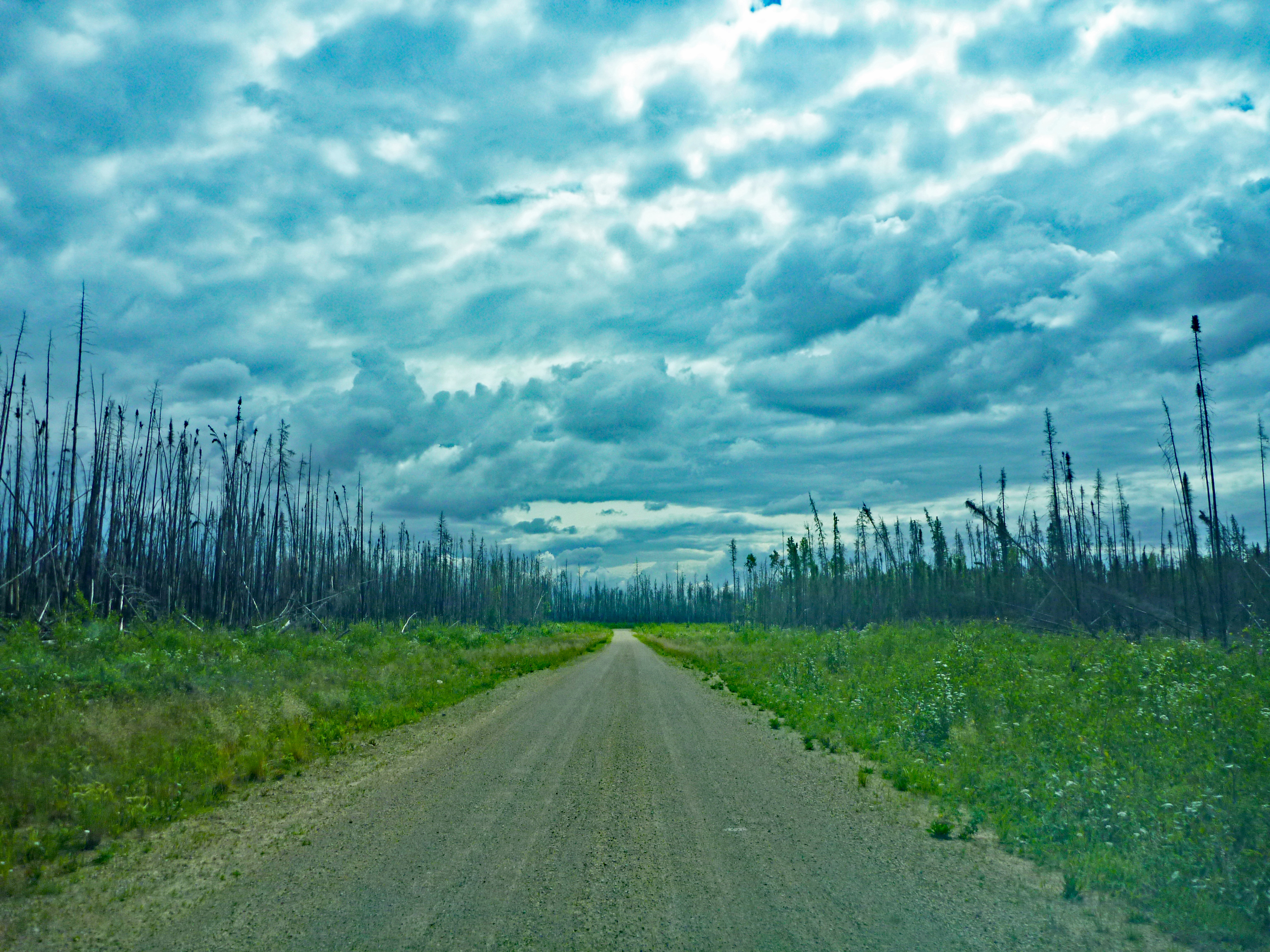
Just a note on the solitude you will find in the Northwest Territories. This road traveled about 10 kilometres in from Highway 5, just outside of Fort Smith. We did not see another human being during the drive in and out or during any of our time at the Salt Plains.
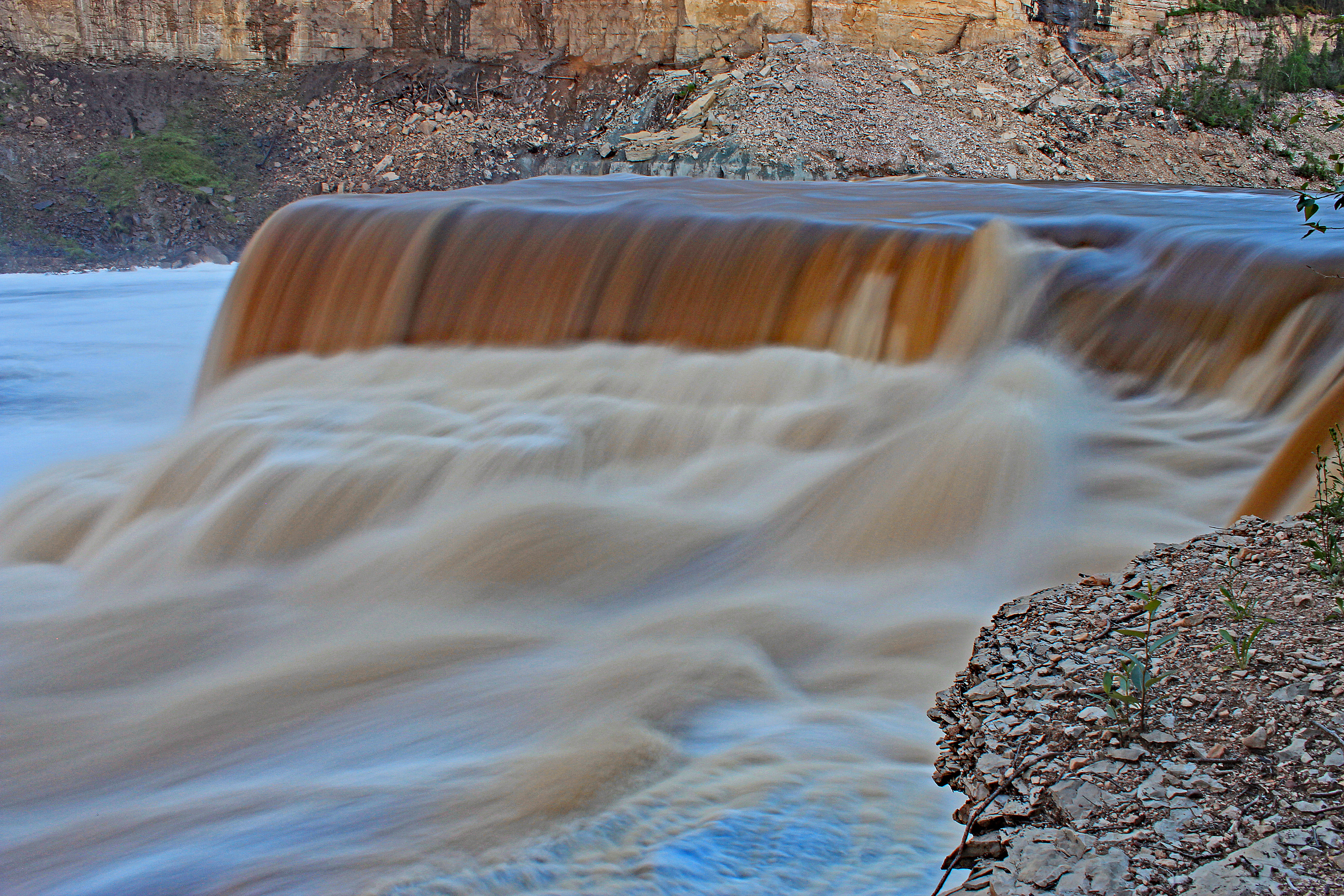
17. Canyons
Be careful, though. The cross shown in the image is testament to the dangers involved here. My best description is that it is not a waterfall but a ‘gauntlet to hell’.
These falls, Coral Falls and the Trout River are all within walking distance of the Sambaa Deh Falls Territorial Park. This is an excellent campground run by excellent people.
18. Black Bear
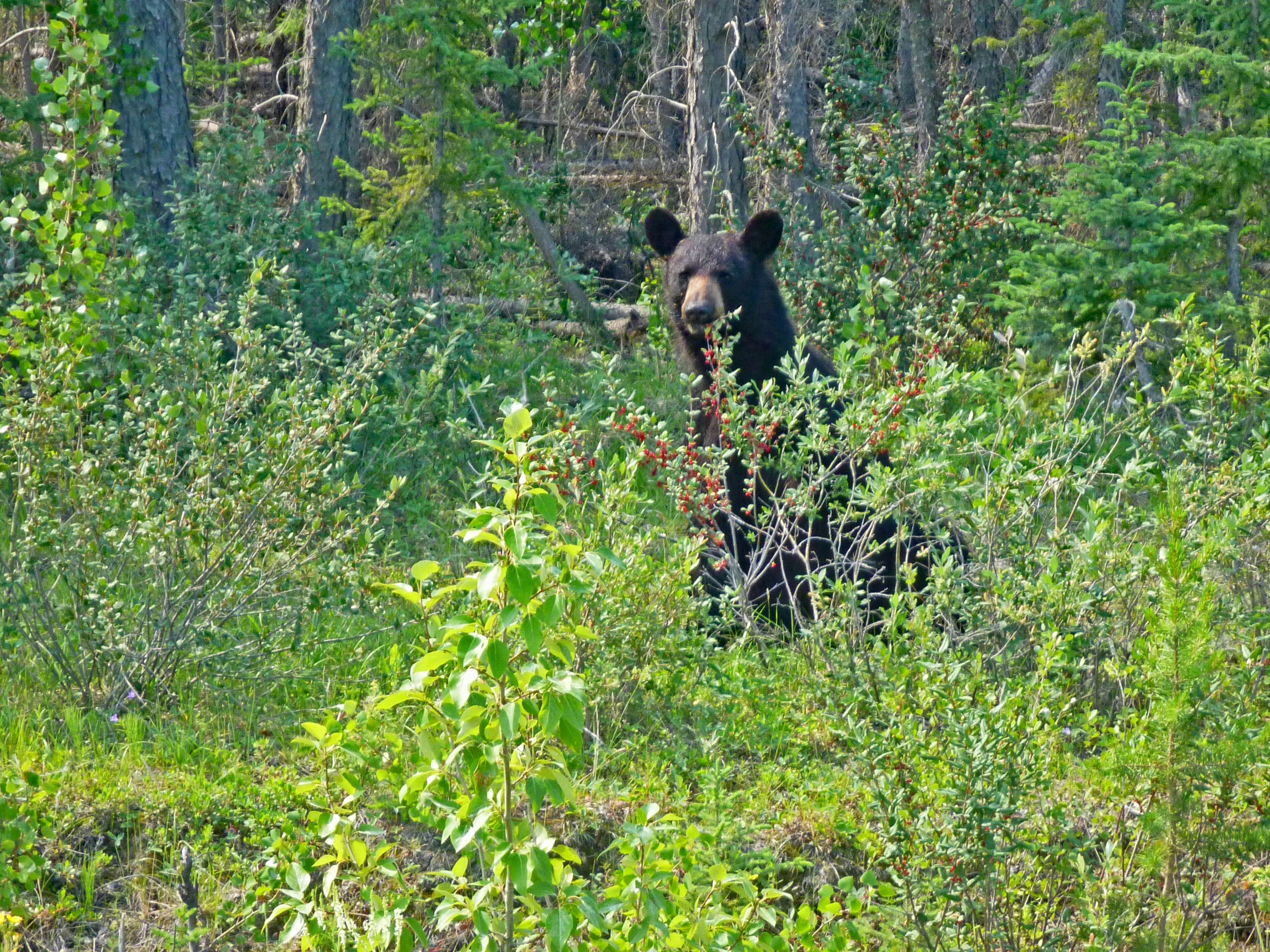
When you get further south to the camping cities that are Jasper and Banff, try not to laugh when the registration people ask with their deathly serious tones if you know you are in ‘bear country’!
19. Cracks in the Windshield
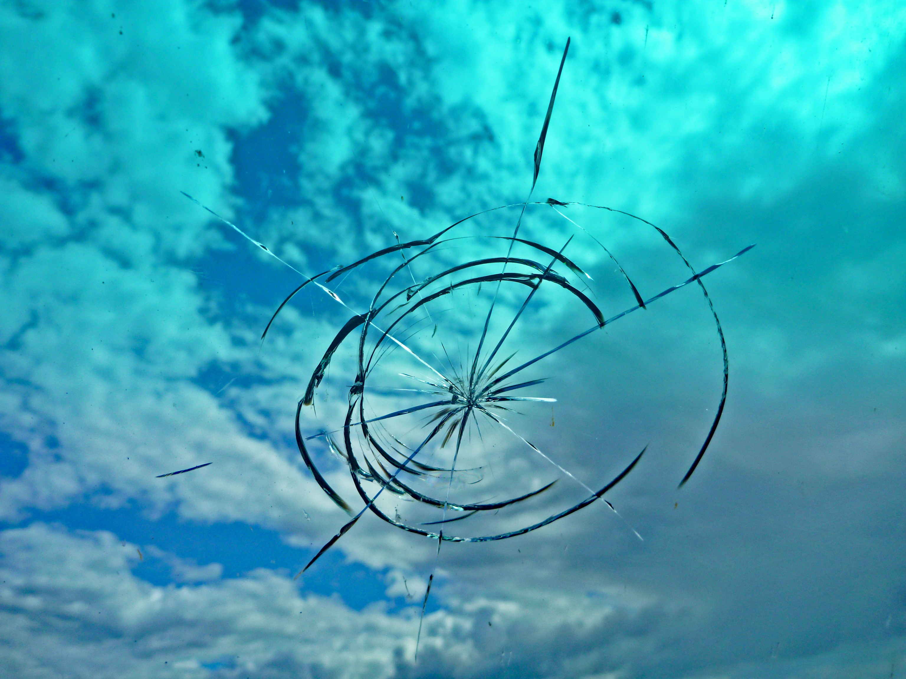
Talking with locals on the Fort Simpson Ferry, I found this was normal. People from the Northwest Territories don’t get windshield cracks fixed because it’ll just broken again, if not the next day then shortly after.
