
Subtitle: Where Real Canadians Live…
Winter is tough in Ontario, especially with a toddler in tow, to get out and exercise the photography muscles and maybe see something new. I had the chance this past week. I was on my way up to Sudbury, Ontario via North Bay to pick up our 18 year old at Laurentian University to bring him home for reading week. He wouldn’t be ready until 5pm so I had a full day planned for myself that started at 5:30am.
Unfortunately, Mother Nature had other plans for me. The temperature was a decent -9 when I left home. That’s in celsius. For those that speak American, that equates to a balmy 16 fahrenheit. By the time I got to Bracebridge, the temp had dropped to -18c, or zero on the F scale. Still a manageable temperature but the things I wanted to visit were closed off for the season.
Next up was Burk’s Falls. Not really a waterfall but a dam. Still a cute looking place, especially with the snow and ice. I was able to get a few images but the temp had now dropped to -25c or -13f and there was a pretty active wind.
City of North Bay: Gateway of the North

I carried on north on the expansive four lane highway 11. There was little traffic and the road seemed clear. After a few strong gusts, I realized the road wasn’t as clean as it looked. Luckily, I was playing it safe and was driving below the speed limit as a gust of wind pushed the back end of the van out and I fish-tailed for a short, white-knuckled period of time.
After an hour of driving on black ice, I got to North Bay. With the temps frozen at -25, I made the best of it. For anyone from the U.S. reading this, yes, these temperatures are a little Minnesota-ish. In fact, North Bay is slightly closer to the north pole than Minneapolis.

On the shores of Lake Nipissing, I was the only sight-seer. But, the lake was not void of humans. Ice fishing is popular on the lake and there were huts scattered about. Nipissing is the third largest lake in Ontario that is not one of the Great Lakes. It covers 873 square kilometres or 337 square miles.
The maximum length is 65km or 40 miles while the max width is 25 km or 16 miles. Although Nipissing is 52 metres or 171 feet deep at its deepest point, the average depth is just 15 feet. The lake drains into Georgian Bay via the French River. It was once a main portion of the fur trading canoe route across Canada with pioneers coming up the Ottawa River and across the Mattawa.
Above is a CF-100 on display at Lee Park.

The original Chief Commanda sits frozen at the dock in North Bay. Replaced by the Chief Commanda II, the younger ship spends its winters in much nicer accommodations. In the summer, the ship provides cruises of Lake Nipissing.
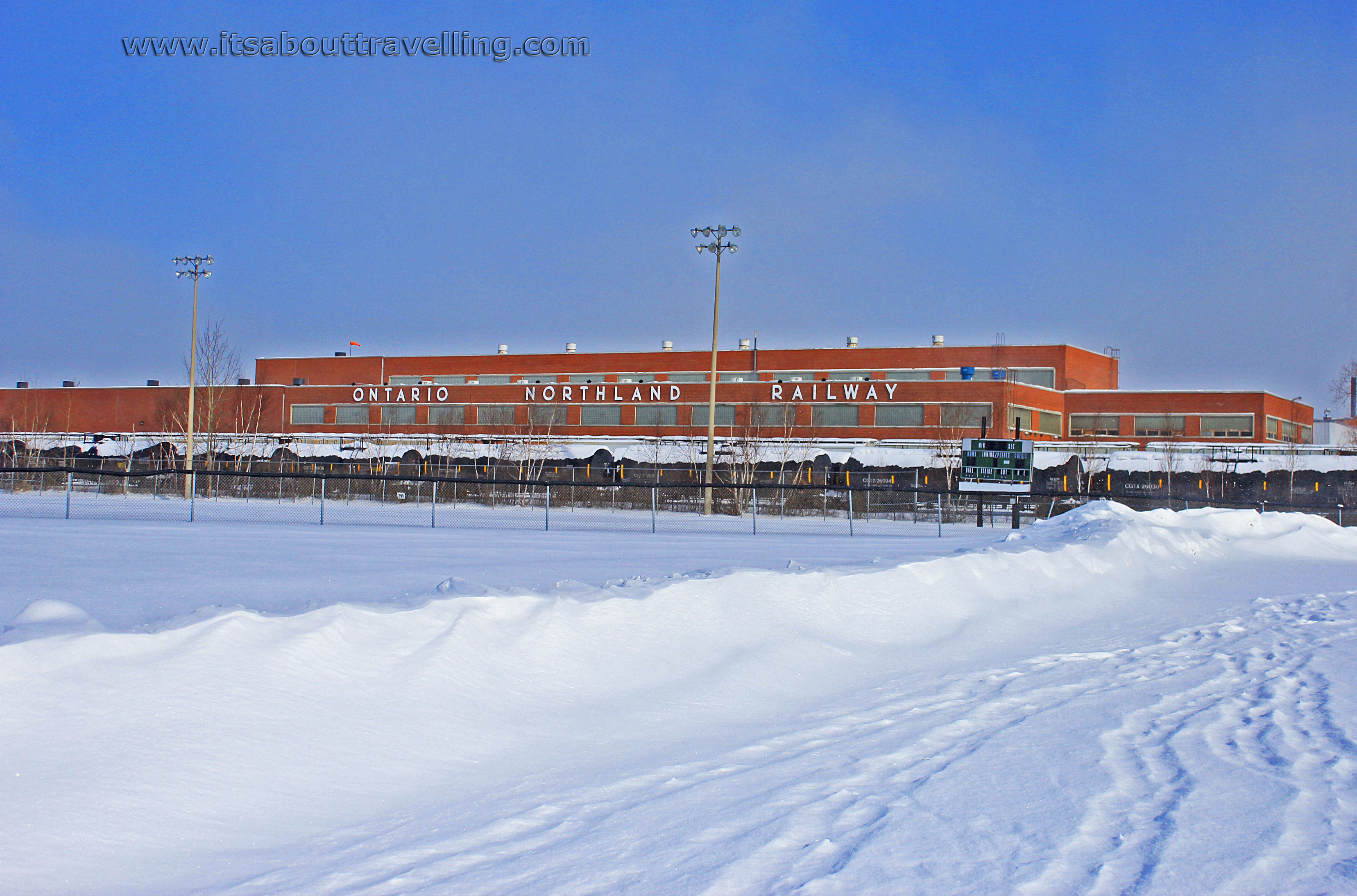
North Bay is the southern terminus of the Ontario Northland Railway. These are the people that run the passenger train all the way up to Moosonee, Ontario near the bottom of James Bay.
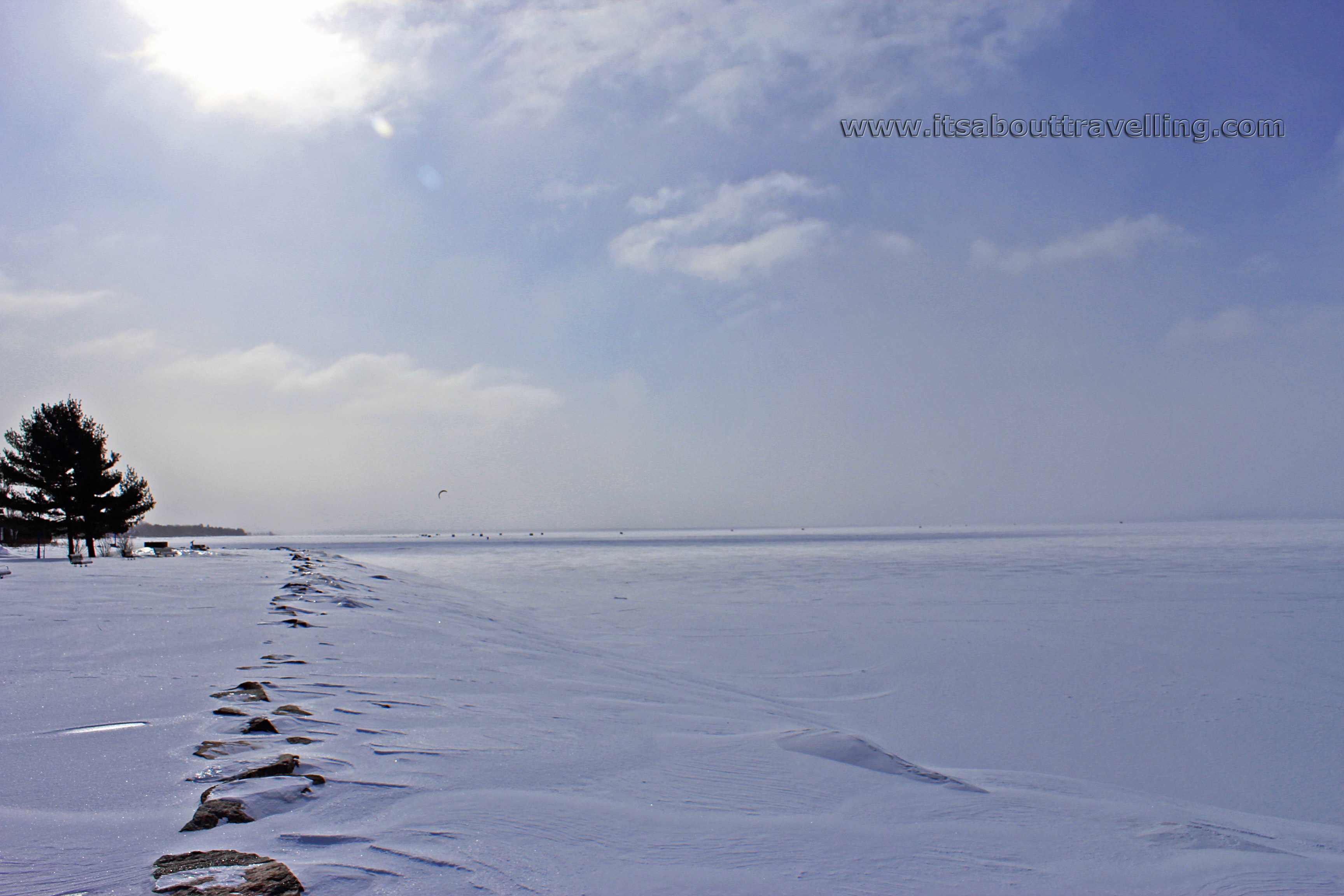
We, in Canada, are told through a constant bombardment of advertisement that real Canadians brave standing in a heated arena for an hour or have to roll down their window at a drive-thru to get their coffee on a cold winter’s day. The ‘Real Canadian’ was out on Lake Nipissing that day. There was a single guy scooting along, doing some kite-skiing. You can catch a glimpse of him in the above and below images.
The temp before the wind chill was -25 and there was enough wind to easily propel him along the snowy/icy surface. I had frost bite setting in on my cheeks after about ten minutes along the shoreline and I felt I was bundled up pretty good.

North Bay was incorporated as a town in 1891 about the time it became an important cog in cross-Canada railroad. The seat of Nipissing District, North Bay has a city population of 54,000 and a metro population of around 64,000. Those numbers have grown little since the 1970’s.
The city is located 344 km north of Toronto and 128 km east of Sudbury at the northeast corner of Lake Nipissing. During the Cold War, an Air Force base was established in North Bay. 60 storeys below the ground, the home of the Canadian NORAD operations was established. CFB North Bay remains and shares Jack Garland Airport with the civilian world. A small commercial airport, because the runways are super long because of the Air Force, Jack Garland is an emergency back-up for Pearson International Airport in Toronto and housed several aircraft during the 9/11 crisis.
Nowadays, North Bay is fuelled by government, education and tourism. The city is home to both Canadore College and Nipissing University.

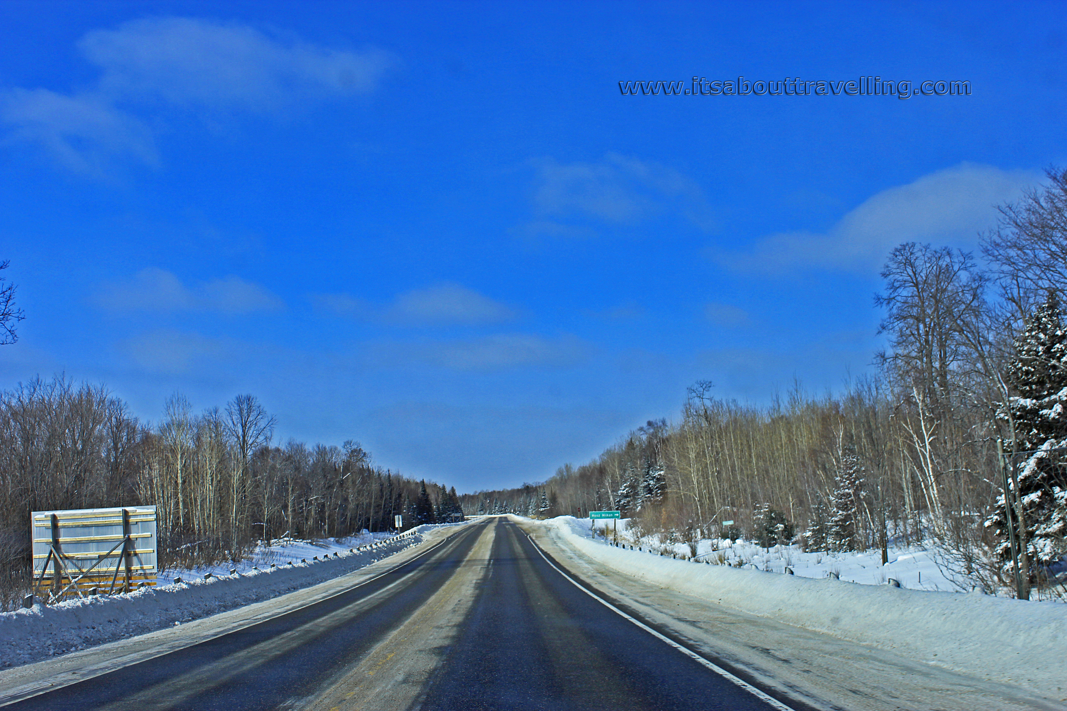
Above is the view from a walking bridge in Burk’s Falls, just below the hydro dam. Below is a typical scene on the Trans-Canada Highway between North Bay and Sudbury.
Was this road trip a success? Not the way I’d hoped but it served as a great scouting tour. I definitely want to revisit North Bay in warmer weather and I now know exactly where Duchesnay Falls are, just outside of North Bay. This has been a waterfall I’ve wanted to explore for a while. It’s located just off highway 17, just east of the hospital in North Bay. There was, unfortunately nowhere to park and the falls looked completely covered over in snow.
The video below was taken the same day and shows a drive-thru POV of downtown North Bay, along Main Street. First, I sped the drive up to 4x normal for an express version. Following that, you can see the drive at regular speed. I did this because I get a lot of complaints for not showing drive-thru’s on YouTube at regular speed. If you’re watching, I’d appreciate you clicking the ‘Thumb’s Up’ button!
North Bay, Ontario Video

Resources
