I am from Canada. One of my country’s, and the world’s, greatest natural attractions is Niagara Falls. Yet, I fully believe the spectacle is best viewed from the American side of the Niagara River.
It’s funny, I grew up with the impression of our neighbours to the south being overly commercial, crime ridden, tacky, dirty litter bugs. In your mind, you saw the river burning in Buffalo. You saw gang warfare and muggings, a la the movie ‘Warriors’. You saw yourself walking knee deep in Big Mac wrappers and giant Slurpy cups. That is, if you could see anything beyond all the waving flags.
In 2014, it seems that Canada and the United States have switched roles in many respects. Canada, at least Southern Ontario, has become everything that we didn’t like about our neighbours. And, the U.S. has seriously cleaned up their act.
Niagara Falls is as good a case study of this that there is.
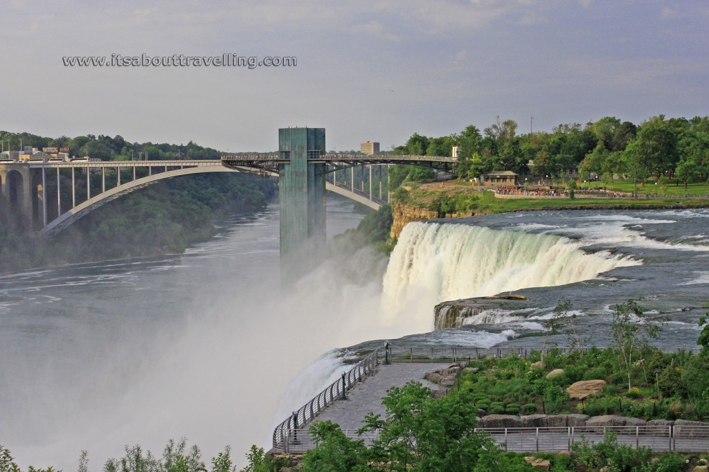
The above image shows Rainbow Bridge crossing from Niagara Falls, Ontario to Niagara Falls, New York. In the forefront is the vacant observation area of Luna Island. The area is not abandoned, just vacant as the bridge between Goat Island and Luna Island gets a rebuild.
Luna Island is seperated from Goat Island by Bridle Veil Falls. This area was closed to the public from 1954 to 1972 due to the instability of the rock beneath. After temporarily ‘turning off’ the American Falls in 1969, reinforcements allowed the island to reopen three years later.
Originally, the piece of land that is less than an acre in size, was named Prospect Island. The name change came to honour the fact that before light pollution invaded the region, moonbows or lunar rainbows could be seen here during the full moon.
The half-bridge looking structure beside the Rainbow Bridge is the Prospect Point Park Observation Tower. It is 86 metres or 282 feet above the Niagara River and is the entry point for those riding the Maid of the Mist from the U.S. side. Originally built in 1961 and considered an eyesore by folks from the Canadian side, the tower was extensively refurbed in 2001.
What is the greatest reason why the U.S. side of Horseshoe Falls more appealing to me? The number one reason is the amazing feeling knowing that a simple 3-4 foot railing is all that holds you back from putting your hands in the crest of one of the world’s great waterfalls. The view is just so much more up close and personal than from the other side of the river – and often much less crowded.
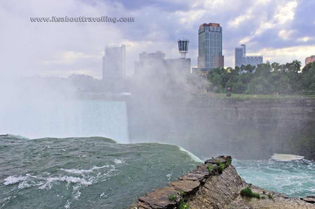
The retaining wall you see at the left of the above image was constructed in the early 1980’s by the United States Armed Corps of Engineers. It was built in order to protect the waterfall from erosion and it is said to have pushed the waterfall far enough that it is now fully in Canada. This observation area of Goat Island is known as Terrapin Point.
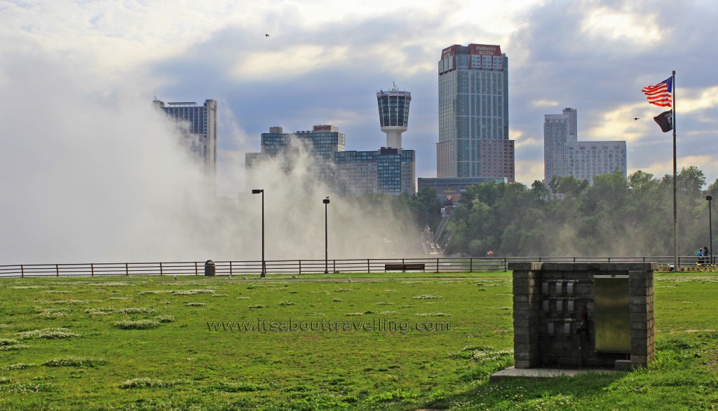
The constant mist kicked up by Horseshoe Falls and the nearly constant winds from the west help create a micro ecosystem on Goat Island. In winter, this area of Niagara Falls State Park is coated in sometimes several inches of ice and is nearly impassable.
Across the River is the hotels and casinos of Niagara Falls, Ontario – Canada’s version of Las Vegas.
As for Niagara Falls State Park, it includes much of the riverfront area from Goat Island, down the Niagara Gorge to Lewiston. This is the oldest state park in the United States, dating back to 1885. It was named a U.S. National Historic Landmark in 1963.
The Three Sisters Islands are a bit of a secret on Goat Island. There are actually four islands, all named for the children of General Parkhurst Whitney, an American Commander during the war of 1812.
Whitney and his daughters were the first to visit these outer islands of Goat Island. It is thought that they visited in winter when an ice jam upstream reduced the flow to a trickle. So proud of his daughters, Whitney asked the owners of the land at the time if he could change the names of the islands. The owners agreed.
The first island, formerly known as Deer Island, is now Asenath Island. The second is Angeline Island and the third is Celinda Elize Island. There is a fourth island that is not connected by bridge. This island is named for Whitney’s son and is called Little Brother Island or Solon Island.
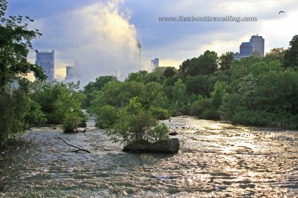
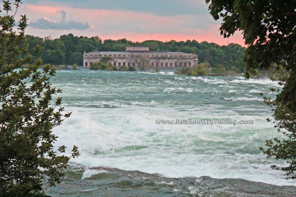
From Celinda Eliza Island, the view is of a raging Niagara River and the power plants on the Canadian side. The building shown above is the Toronto Power Generating Station. This structure was built in 1906 and ceased operations in February, 1974. In 1983, it was designated a National Historic Site of Canada and ownership was transferred to the Niagara Parks Commission in 2007.
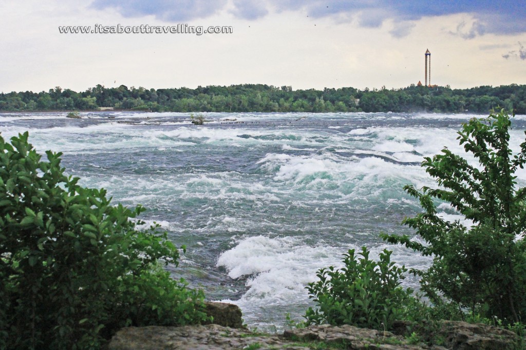
Another view from Celinda Eliza Island shows again the raging waters of the Niagara River just above Horseshoe Falls. The tower in the background is the Sky Screamer ride at Marineland in Niagara Falls, Ontario. The structure is 137.2 metres or 450 feet above the ground and takes riders at speeds of up to 96 km/h or 60 mph.
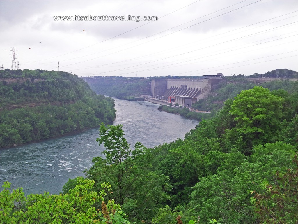
The Niagara Falls State Park also includes the Niagara Gorge trail system. One can descend to the base of the Niagara River and hike upstream a fair distance back towards the waterfalls. Along the way, the trails pass by Devil’s Hole Rapids.
At the right side of the river in the above image is the Robert Moses Niagara Hydroelectric Power Station. This current plant opened in 1961 after the previous plant, the Schoellkopf Power Station collapsed in 1956. There are 13 generators and the plant sits directly opposite the Sir Adam Beck Hydroelectric Power Stations on the Ontario side of the river.
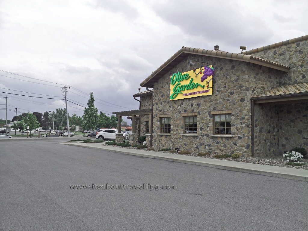
But, the real reason people from Ontario visit Niagara Falls, New York is to eat at Olive Garden! This restaurant chain was founded in 1982 and has 818 restaurants around the world. There are still six locations in Western Canada but not in Ontario. At one point, there were up to 15 Olive Garden restaurants in Ontario but all closed in the early 2000’s.
However, it was not for lack of popularity and it really has become a destination when crossing the border. Olive Garden would seem to know this, putting this location right beside the now famous outlet mall on Military Road – a haven for Canadian shoppers for decades.
The video below is a series of clips taken the same day as the images above. It better shows the power of this natural wonder with the addition of sound and motion. Take a look in HD if your connection and computer can handle it (in other words, if it’s better than mine…). Don’t forget to give it a thumbs up!


