Mount Carleton – The King of the Maritime Provinces. This mountain at the northern end of the Appalachians in North Central New Brunswick is the highest point in the provinces of New Brunswick, Nova Scotia and Prince Edward Island.

The 820 metre / 2690 feet peak is one of three mountains over 2500 feet located within Mount Carleton Provincial Park. The park is a secluded forest paradise that provides incredible views at every turn. Over 100 kilometres from Saint-Leonard to the west and over 100 from Bathurst in the east, Mount Carleton is a park for people not wanting to see people and not wanting the annoyance of modern day wireless communication (aka. cell phones).
In a province with an estimated population of just 750,000, Mount Carleton is one of only nine provincial parks. In contrast, the much larger and much more populated province of Ontario has over 600 parks and reserves. However, quantity is no match for quality in New Brunswick.
The main campground, Armstrong, is cozy yet private with just 88 trees surrounded by thick

evergreens. There is one main indoor shelter and a washroom with flush toilets and showers. At the entrance to the campground is a store selling ice, firewood and a small selection of grocery necessities. The sites at Armstrong cost $25 per night, including tax, as of the end of the 2011 season.
A total of 17 sites are split between Williams and Franklin campgrounds. These are tenting only sites where campers park and walk via hiking trail a short distance to their sites. These sites are serviced with pit toilets only. The cost is cheaper at $15 per night.
Headwaters is a small group of four campsites along the trail up Mount Carleton and are only accessed by hiking trail. These sites are serviced with just pit toilets.
In all, not including ski trails, there are 57.6 km of hiking trails within the park spread over ten trails. The trails are all intertwined and hikes of great lengths can easily be had without backtracking. The trails are rugged with rocks, water, steep climbs and somewhat precarious brook crossings (bridges are formed by strapping two to four logs together and can be very slippery in wet weather).
The featured trail, of course, is the one that runs at a constant climb to the summit of Mount Carleton. The trail is a loop from the parking lot with the eastern route being less rugged. Following the eastern trail, it is approximately 6.0 km to the summit with the last 400 metres being a nearly verticle rocky climb.
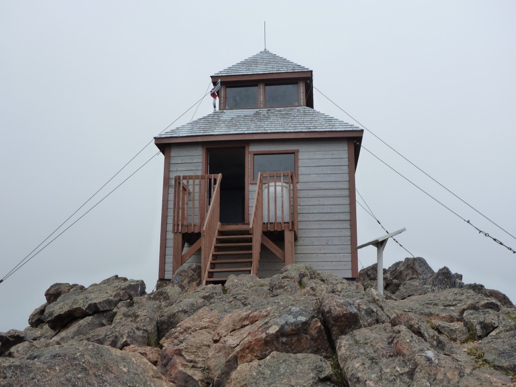
The summit of Mount Carleton offers incredible views of the mountainous landscape in all directions. It is said that one can see right to the State of Maine in the United States on a clear day. At the summit is a small cabin or watch tower signifying where forest fire spotters used to stand watch. The tower was abandoned by active fire watchers after 1968 when airplanes took over the search for forest fire activity.
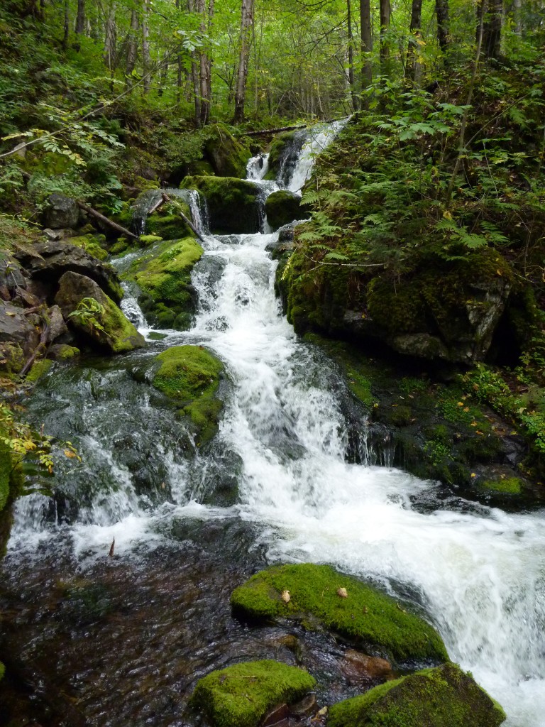
Waterfalls dot the trails of the park and its many mountain brooks. There is a short trail to Williams Brook Waterfalls near the main camping area. The Dry Brook Trail runs directly along the course of Dry Brook and the hiker is rewarded with several waterfalls and rapids along the route.
There are moose in the park and even if you don’t spot one, evidence in the form of large tracks is a constant on the hiking trails. An animal that will be surely seen at night is the red fox. Fishing is limited to catch and release and only by fly-fishing method.
How to get there (1300 km from Toronto ~ 12 hour drive):
From Ontario and Quebec – follow the 401 east to the Quebec border. Take hwy. 20 (use the
hwy 40 northern by-pass to get through Montreal as hwy 20 is atrocious through the city) to Riviere-Du-Loup and turn right onto hwy 185. Follow this road to the New Brunswick border where it becomes hwy 2. At this point, the road widens back to a four lane freeway that hasn’t been present since Riviere-Du-Loup. Follow hwy 2 for about 60 km until hwy 17 at Saint-Leonard. Take 17 east for 80 km to Saint-Quentin (last Tim Horton’s before the park!). Turn onto hwy 180 (park signs will be quite prevelant by this point) and travel 27 km to hwy 385. From this point it’ll be about 7 km to the park office.
From the south – take hwy 2 north, turn onto 17 at Saint-Leonard and follow the above directions.
From the east – take 180 west from Bathurst.
Our personal take:
We were recently asked by the Ontario Provincial Parks to fill out a survey on what they could do to improve their campgrounds. The survey took Angie about a half hour to fill out. However, with once sentence we could have fixed their problems – “Do what New Brunswick does!”
Mount Carleton was classy yet basic. It was a camper’s campground with none of the excess that is used to lure non-campers to the park. There were no sissy wood-chip covered or paved hiking trails. The focus of the trails in this place was to challenge the hiker’s physical abilities while taking him/her into an environment where humans are once again just a member of the food chain. In other words, you have to earn the right to view Mother Nature’s inner beauty.
If you visit, you MUST climb to the summit of Mount Carleton. To visit the park and see the amazing views from atop the mountain would be a giant shame. The eastern route is not overly challenging, just a monotonous journey at a constant incline with nothing to see but forest until the final 400 metres. The summit can be had in no longer than two hours. It took us not much more than an hour to reach the top.
The northern part of the province of New Brunswick is an extension of Quebec, as far as language goes. Most locals are French first but do mostly speak English.
Bathurst is a great excursion for a half or full day. Located on Chaleur Bay, Bathurst is 120 km from the park and is a somewhat major city. Chaleur Bay is located on the Gulf of St. Lawrence which, in turn is on the Atlantic Ocean. So… technically, it’s a visit to the Ocean and therefore is a great place for a seafood meal.
360 of the Mount Carleton Summit:
