
If only for one night of camping, I had a real blast from the past this week. We stayed for an evening at Falls Reserve Conservation Area, near Goderich, Ontario. Maitland Falls was once one of my family’s go-to campgrounds when I was growing up. I hadn’t been there in more than 25 years.
I have fond memories of spending the day at Maitland Falls, jumping and diving directly into the waterfall. I would also spend a great amount of time beneath the surface with a mask on, checking out the wide display of fish and filling tackle boxes with retrieved fishermen’s snagged hooks and lures.

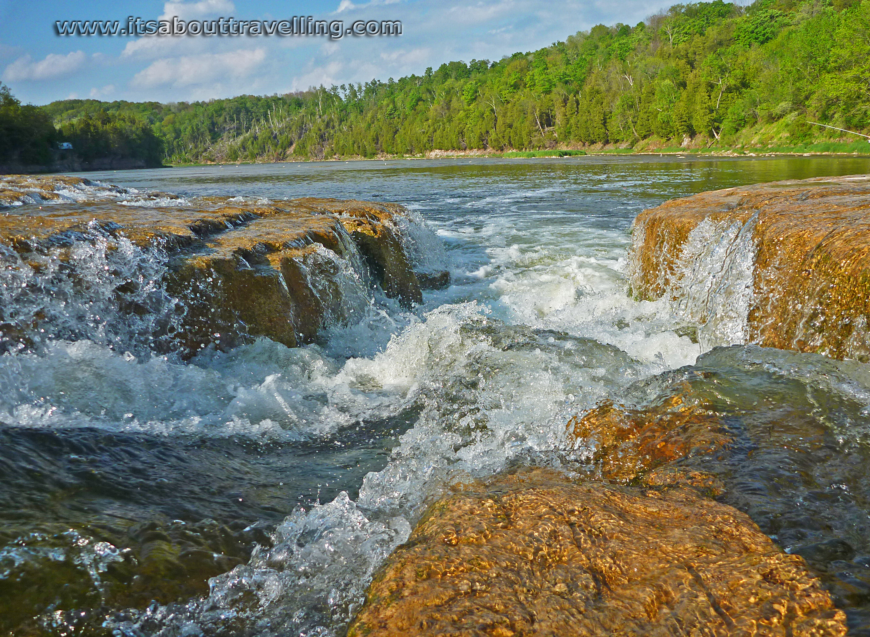
Maitland Falls
Going on a Monday evening in May had its benefits. The campground was nearly empty, save for a few other tents. In fact, the campground was even void of employees for most of the visit. During the week in the off-season, there is no one manning the front gate or the snack bar. The park operates on the honour system with campers dropping their fees off in an envelope at the front gate.
Falls Reserve Conservation Area is located along the Maitland River, about ten minutes east of Goderich, near the hamlet of Benmiller, Ontario. This is the area affected by a F3 tornado on August 21, 2011.
The tornado developed over Lake Huron before causing extensive damage to the downtown area of Goderich. The tornado then travelled east and crossed the Maitland River just downstream from Maitland Falls. In the above image in the far left, you can see the remaining destruction done to the trees on the shores of the river. The tornado also caused damage to the nearby Benmiller Inn. Fortunately, the campground was not directly affected.

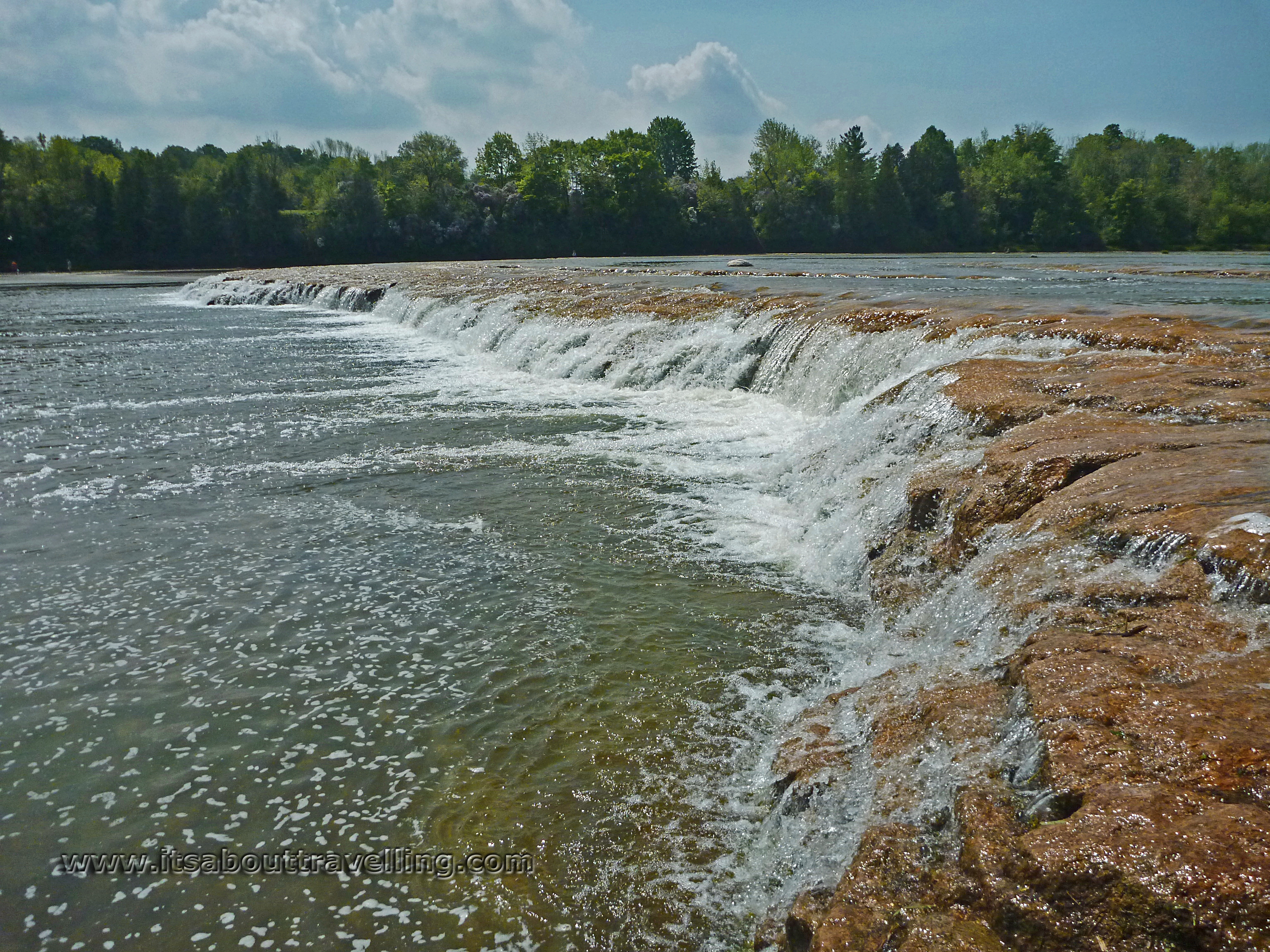
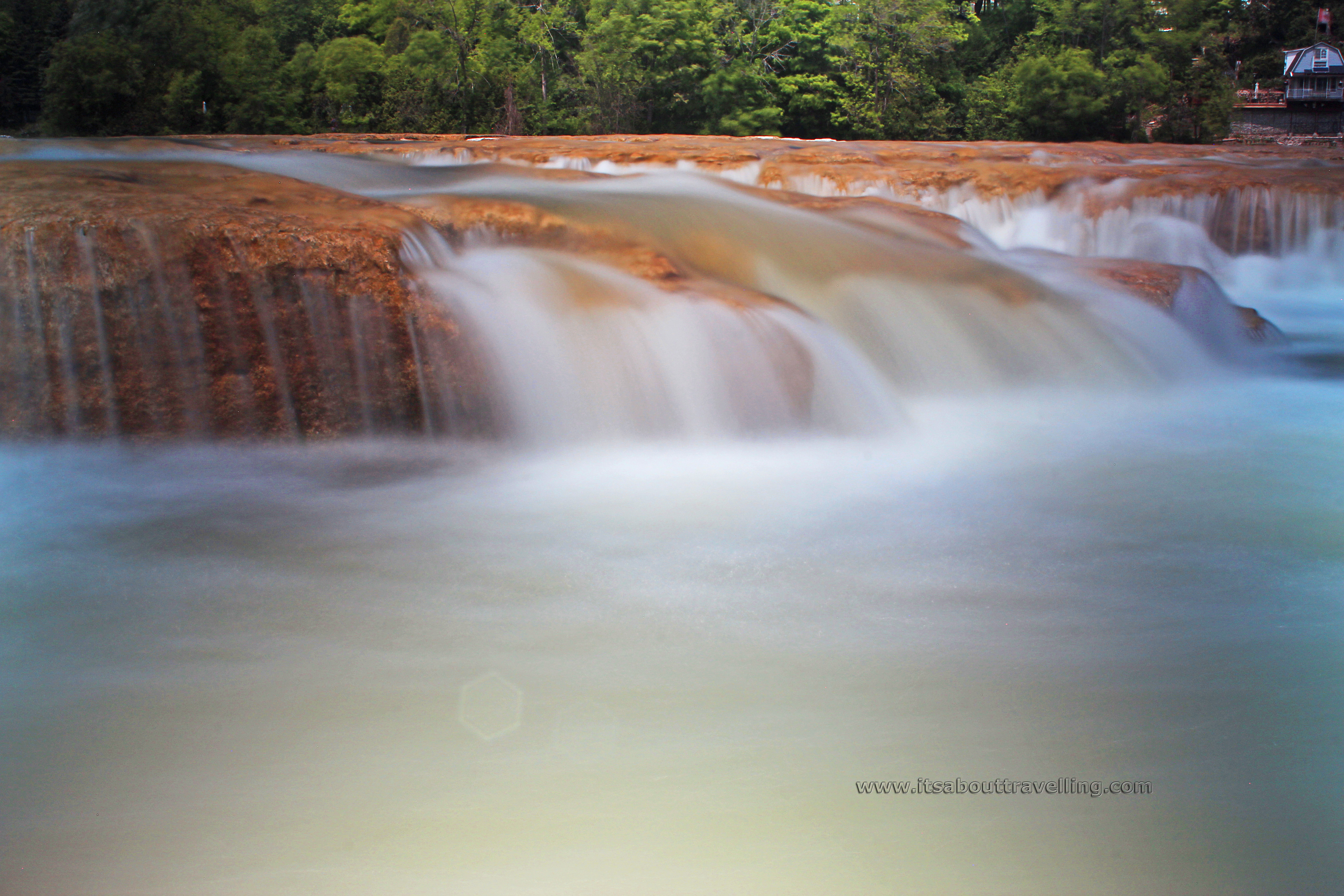
What makes the Maitland Falls unique is not the vertical plunge. This is a short waterfall but it is long. Early in the season, the waterfall covers much of the full width of the wide river. Water flow is quite reduced as the summer goes on. Because the clear water at this point is flowing over flat smooth rock with cuts, or channels, where the main water flow is, it is often no more than knee deep and provides a refreshing walk for visitors.

Falls Reserve Conservation Area
The campground at Falls Reserve has 190 campsites spread over three main areas, Mennesetung, Chippewa and Sycamore. Chippewa is unserviced (where we stayed) while Mennesetung and Sycamore are serviced with water and either 15 or 30 amp electricity. The serviced areas are well-populated with seasonal trailer campers. There is also a walk-in tenting area with a handful of sites. Sites range from $36 to $52 per night, depending on level of service.

Day-use fees are $7 per adult or $15 per carload. Fishing in the river is free, as long as you have the required provincial license. However, there is an $8 fee to fish at the stocked pond near the front entrance. The pond is stocked with Rainbow Trout each year and those fish are typically fished out over the summer. The pond also has a self-sustaining population of Largemouth Bass. There is a two fish limit on the trout while the bass are strictly catch and release.
I’m not sure why any self-respecting angler would fish the pond. The Maitland River is teeming with fish with populations resembling a tropical reef at times. The featured fish is the Smallmouth Bass but there are also trout and salmon. White Sucker and Bullhead will inevitably get on your hook. If you love a good fight, there are also some monster Carp.
I recall heading downstream and around the bend as a teenager to fish a bit a trench in the river. That location was always a guarantee for some decent sized Smallmouth and a whole whack of sucker. When the main waterfall area gets full of bathers in the summer, this was a great option for fishing without hooking a human or two.
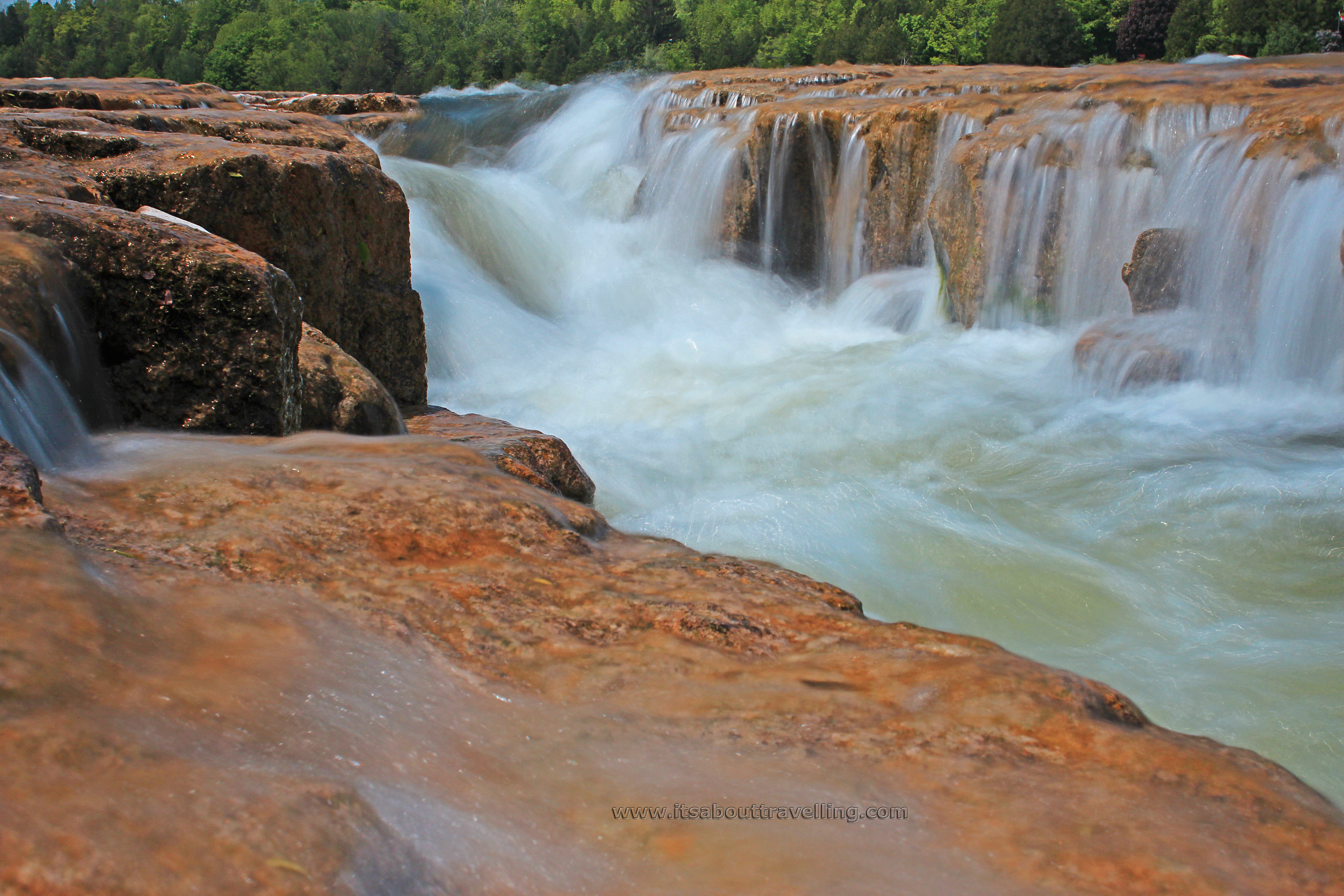
While most of the images here are of the main waterfall section, closest to the campground side of the river, the above image was taken from the far side, looking back toward the main waterfall. There are more views of this area in the video below.
We didn’t get in swimming on this visit. Mostly because this is the season for fishermen to take over the waters around the waterfall. However, the water was definitely warm enough. The walk across to the far side was nothing less than pleasurable. Not to scare people off but there was a healthy population of leeches wherever the water slowed its pace. All the more reason to stay in the flowing waters.
Nearby Goderich is definitely worth a visit while at Falls Reserve. Located on the shores of Lake Huron, the town is home to the Sifto Salt Mine, the world’s largest underground salt mine. The mine dominates the northern half of the harbour but pales in size comparison to the action going on far beneath the waters of Lake Huron. The mine is 530 metres or 1,750 feet below the surface and travels miles out under the lake. The salt was discovered in 1866 during a search for oil deposits.
Goderich was founded by William ‘Tiger’ Dunlop in 1927. The town was named for Frederick John Robinson, 1st Viscount Goderich and the Prime Minister of England at the time. Goderich was then incorporated as a town in 1850. Now, there are around 7,500 residents.
The waterfront is well below the main town, separated by a high bluff. There is a beach and a bit of history. At one time, the harbour area was a self-sustaining commercial area that was all but separate from the upper town. Now, little remains from that era.
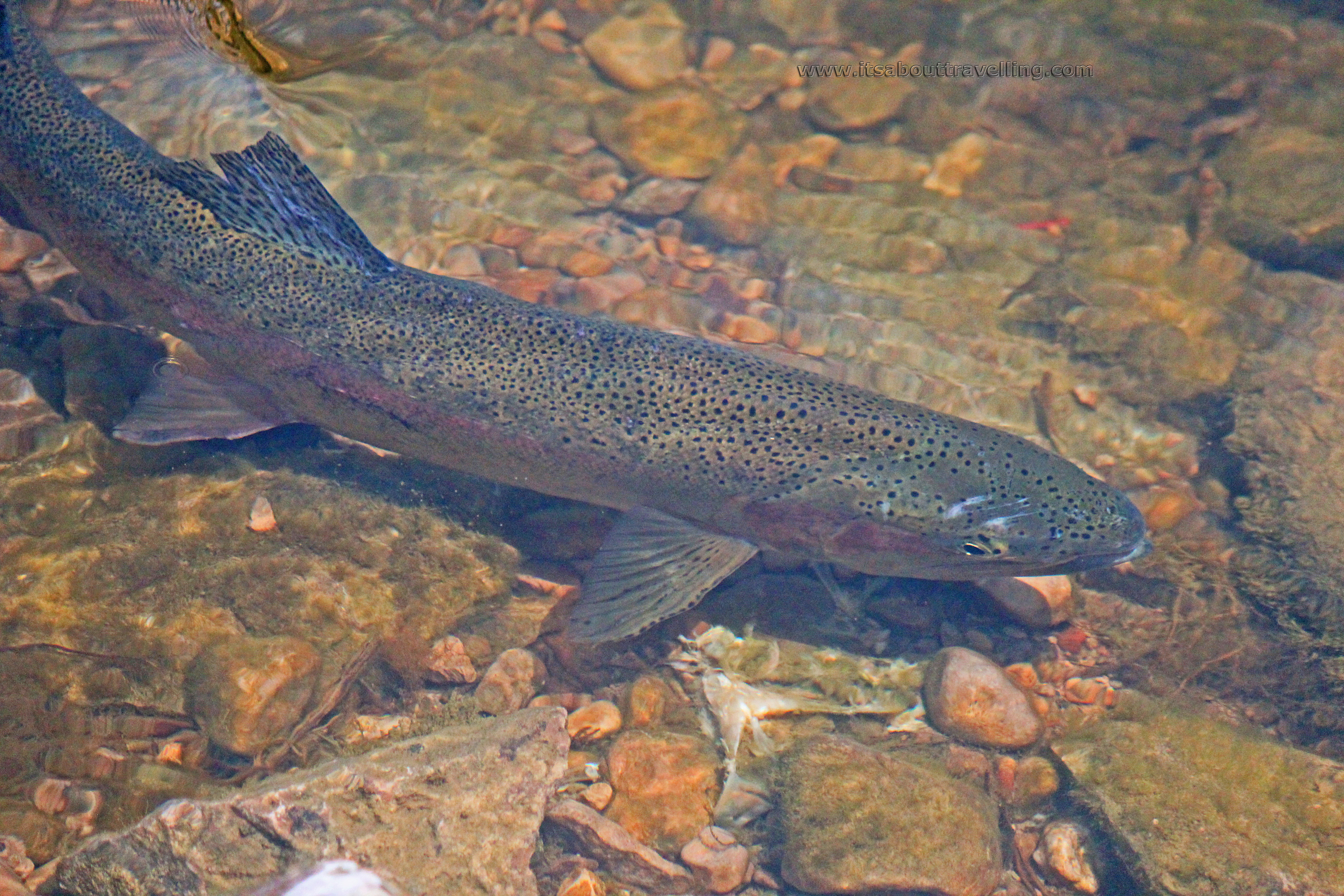
Above is a large Rainbow Trout that had no issues with circling around in shallow water in front of us. Because of the clear water, there were also other large fish visible, mostly the Smallmouth Bass.
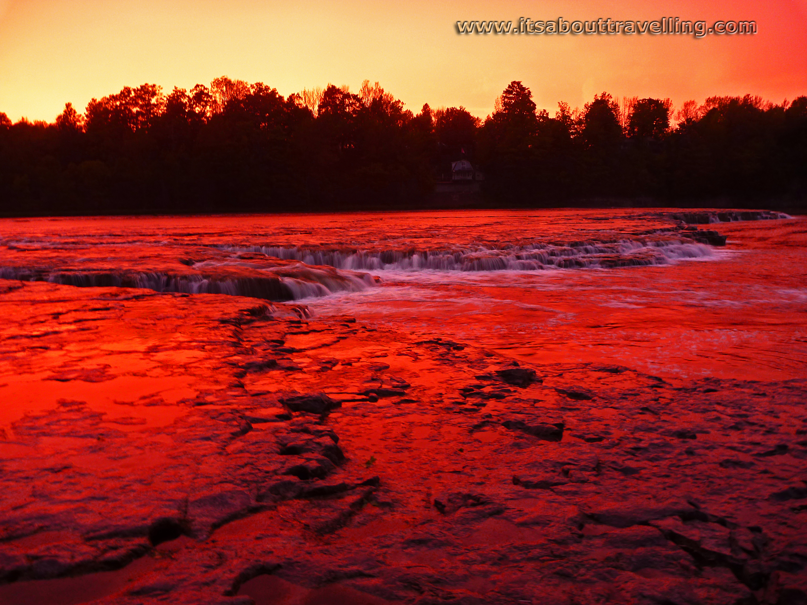
There would be no tornados on the night we camped but it sure looked like it for a bit. A quick storm came off the lake before sunset and the clouds were more than intimidating. The rainfall was fast and furious but didn’t last long. What remained when the clouds moved away was a bright orange sky, enhanced by the water droplets still in the air. The above image was taken shortly before the colour disappeared.
The HD video below shows extensive views of Maitland Falls, from one side to the other and from top to bottom. Check it out – a ‘thumb’s up’ would be greatly appreciated!

