


Severely spraining my left ankle just as the autumn photography season and hockey season are about to begin became one of my worst nightmares realized. Over two months in, I can walk okay but still can’t take a stride in a skate.
Despite the pain, I had to get out and get some fall photos. On October 21, 2019, the colours were and odd mix in Ontario of perfect and non-existent. Trees would be void of leaves at one spot then only a couple of kilometres away the vibrance would be blinding.
I headed out to Grey County, not too far north of my home. I had high hopes for the Bruce Trail at Noisy River Provincial Park but it was a bit of photographic dud. From there, I weaved my way over back roads with Jones Falls in mind.
I made an unexpected stop at the access point for the Beaver River Canoe Route, something I will be exploring further in the spring. Jones Falls didn’t disappoint, although I saw it from a different perspective due to my limited mobility. There were other stops along the way that made the day worthwhile. Check them out in the gallery below with more information following that.
Grey County Autumn Video

Video edited with Corel VideoStudio Ultimate 2018.
Grey County Autumn Photo Gallery
For larger, uncropped versions of the photos in the image gallery, simply click on the individual pictures.
High resolution versions of these images and other photos from the same day are available at Dreamstime. Want to earn cash from your own photos? Why not sign up for free with Dreamstime and start submitting now: Become a paid photographer!


Grey County
Grey County is located north of Dufferin County and west of Simcoe County. The northern most section borders on the shores of Georgian Bay. Established in 1852, there are now around 95,000 residents. The county seat and largest city is Owen Sound.
The county once stretched as far south as Shelburne. However, in 1881, that town became part of Dufferin after that county was formed.
This is an area with a high concentration of waterfalls due to the Niagara Escarpment playing a prominent role in the landscape. Typically, it’s a drive-through area for tourists heading north to the Bruce Peninsula.
Noisy River Provincial Park
This is a non-operating park located on Grey Road 9, just east of the main highway 124 between Shelburne and Collingwood. The entrance off highway 9 is nothing more than a small sign and a walking trail. There is no parking lot, just a bit wider shoulder at the side of the road.
Despite my lack of photos that morning, this is an excellent section of the Bruce Trail to visit. From the road, it’s straight down into the Noisy River Valley. Once you cross the river, it’s straight back up. The trail continues through the typical cedar forest along the edge of the escarpment.
Why was it not a photography jackpot for me then? Mainly, it’s because I showed up too late. The sun was strong and any moisture on the leaves had already evaporated. I had hoped for some mist on the water but that was all burned through. Also, this is a valley full of cedar trees. What leaves there were from the maples, aspens and oaks had mostly already fallen.
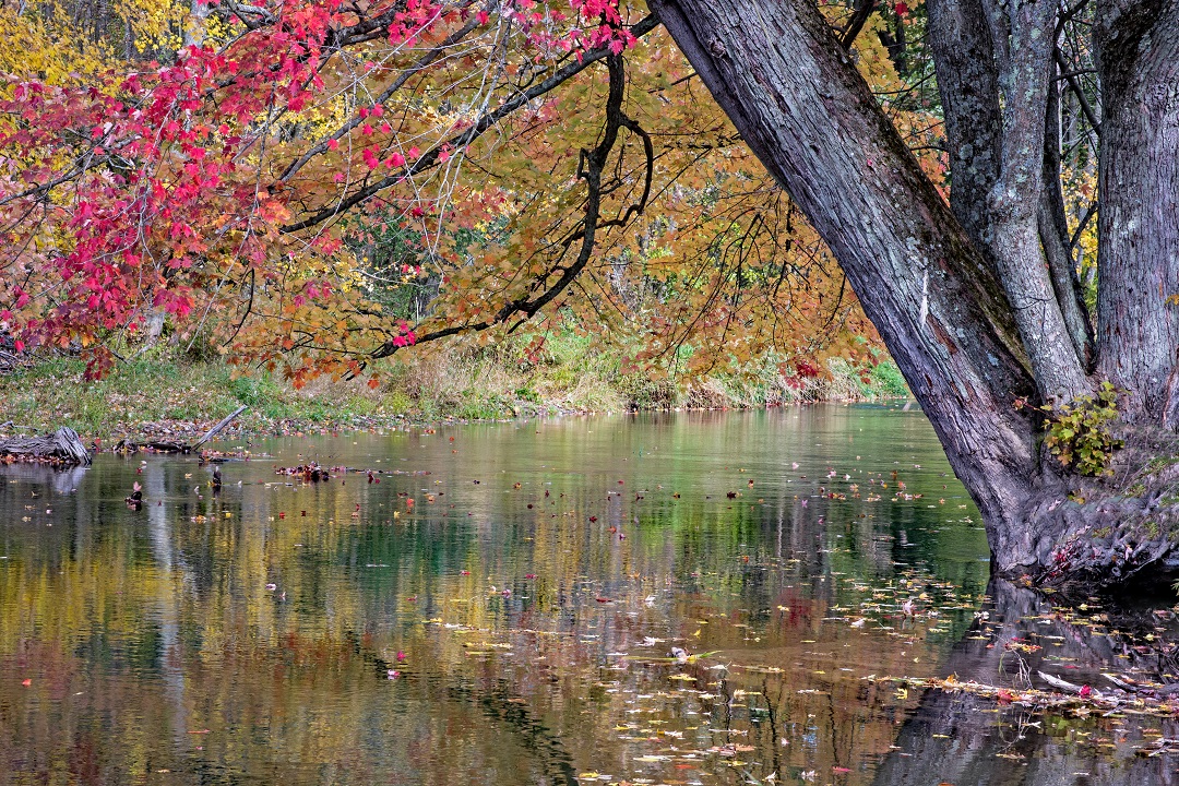
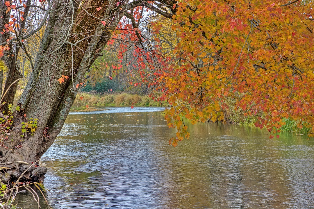
Beaver River Canoe Route Access
The photos in the gallery above showing the maple branches with red leaves hanging over a river were taken at the Beaver River Canoe Route access point. This is located just north of Kimberley, Ontario.
I’ve up this road that travels from Kimberley to Meaford, Ontario more than a few times. This is the first time I noticed the small road sign for the canoe access.
It’s a pretty simply dirt track, barely wide enough for one vehicle. That river is just a short jaunt off the highway and there is a small parking area for may eight to the cars.
I can guarantee that I’ll be back in the spring with the kayak strapped to the roof of the van.
Walter’s Falls
For decades, I’ve passed through this area but never once stopped at Walter’s Falls. This small village is a bit off the main highway but worth the visit. Formerly a mill town, the highlight is the non-operating woollen mill and the waterfall.
Walter’s Falls is a 14 metre drop of Walter’s Creek over the escarpment. The photos I’ve included above are not of this drop but of the mill dam just upstream. You can access the base of the waterfall but, again, my limited mobility was an issue.
Parking is available at The Falls Inn & Spa, a resort hotel that offers some great balcony views of the waterfall. The Bruce Trail runs along the opposite side of the river.
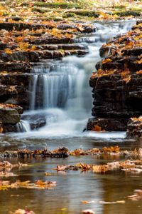
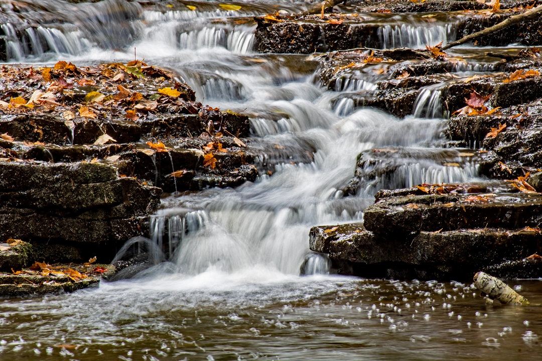
Jones Falls & Pottawatomi Conservation Area
This location is no stranger to this website, and our YouTube Channel. This a small 116 hectare park located at the northeast corner of the intersection with highway 6 and highway 21 in Springmount. This is just west of Owen Sound.
The main waterfall is a 12 metre drop over the escarpment. However, I wasn’t focused on that plunge for this visit. Normally, I head down to the base for some head-on shots of the main drop.
Instead, this time I focused on the small drops just upstream. The water flow was quite low and the main drop was a little weak, anyway. But, the low flow seemed to enhance the smaller, intricate falls above.

Highway 6 Picnic Area
There was one final stop. Along highway 6, somewhere around Mount Forest, I had stopped at an obscure picnic area before. There’s an old road bridge and a dam at the site. It is made quite clear that the bridge is off-limits to visitors. However, you can get a pretty good view from the picnic area.
As you can see from the lone photo in the gallery, the lighting was shit. The bridge is unique but I’m not sure all those hydro wires can be excused from the scene to make a decent photo.
